Finding the Plain of Six Glaciers Tea House, Banff National Park

Legend has it that somewhere high up in the mountains of Alberta lies a tea house hidden among a patch of pines in an otherwise barren landscape.
And by legend, I mean a bartender named Frank.
Let me backtrack. I was recovering from my Cascade Mountain climb at a local hole in the wall called “Eddie Burger + Bar” in downtown Banff. Being a few beers in, I was feeling pretty social and got to talking to the bartender. I was trying to pick his brain about some lesser-known hikes in the area to avoid the crowds (despite contributing to them myself). He began to tell me about a trail to a mountain teahouse…
“Yeah, yeah, the Lake Agnes Teahouse, I heard it was packed with tourists.” I rudely interrupted.
“No.” He said. “That's the quick and easy hike everyone knows about. That’s a highway rest stop compared to what I’m talking about.”
I raised an eyebrow in curiosity as I hid behind my beer, sipping it, embarrassed for interrupting.
“If you really want to see something cool, find the tea house in the Plain of Six Glaciers.”
So off I went, like a character in a video game on some epic side quest. I spent the rest of the night going over trail maps and cross referencing it with the notes I took at the bar.
Once I felt comfortable with where I was going, I crashed out and attempted to get as much sleep as possible. This was going to be a pre-dawn wake-up call.
Part I: Lake Louise Lounging
I woke up to a dark room. It was one of those wake ups where it takes you a second to remember where you are.
I had to get up this early not because this was going to be a particularly long or difficult hike, but because to get there, I had to first get to Lake Louise, one of the most popular spots in all of Banff National Park. The parking lot fills up quickly and once it does, they close down the area. If you don’t get there early enough, you are out of luck.
I hopped in the car to head North-West on the Trans-Canadian Highway. But before I left the town, I stopped to sample some of the local Canadian culture that is Tim Hortons breakfast.
It was okay.
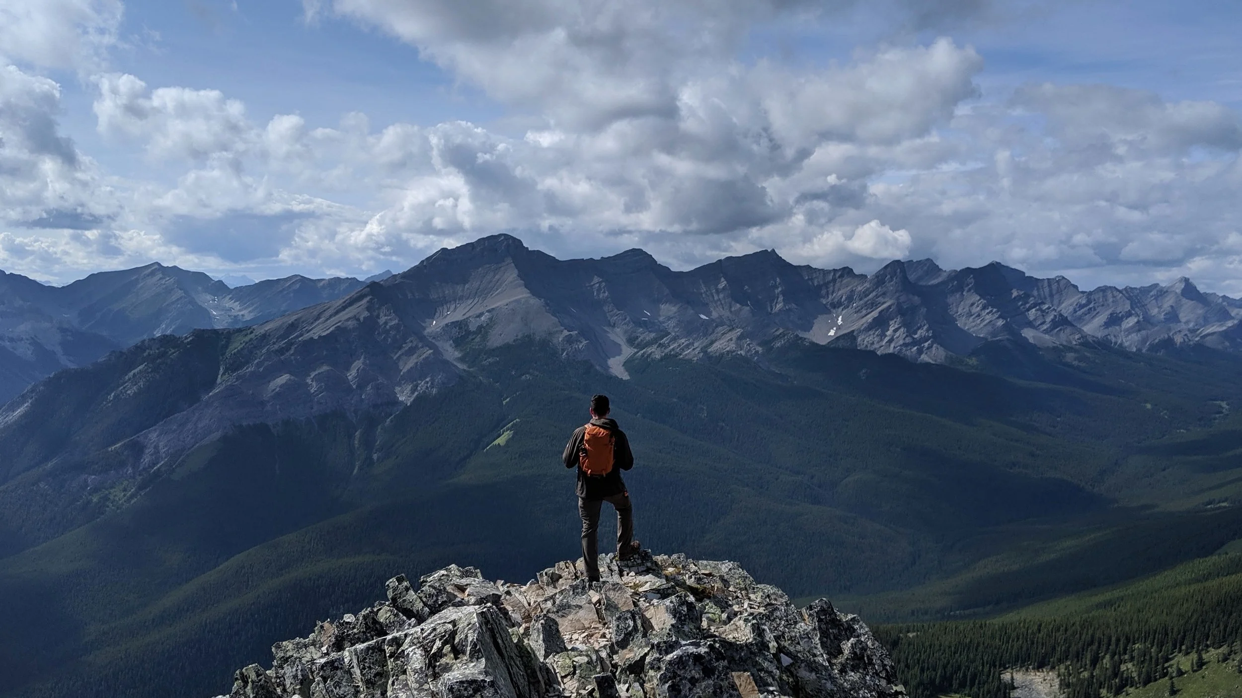
The highway alone was scenic by its own right. The road flows along the Bow River Valley through the mountains. Flanked on both sides by unbelievably huge masses of jagged snow-capped mountains. But not the “so far away it looks like a fake painting” type. These were in your face. The kind that to see the whole mountain I had to hunch forward in the driver's seat as if I pulled up too close to a traffic light. So close you could almost touch them.
I was a little surprised once I got to Lake Louise. From all the pictures I had seen, I got the impression that the lake was in the center of a wilderness area and I would have to go on some sort of trek to get to it. But what the thousands of Instagram photos won't show you is that there is a small town built up around it. Complete with a visitor center, a mall, two baseball fields, some motels, and the massive eight-story Fairmont Chateau right at the lake shore.

None of that mattered though once I got to stand on the rocky shores and look outward. I was transported into an otherworldly experience.
Once I sobered up from the intoxicating views. I was able to find the path I needed to follow.
The first mile and a half (2.4km) started on a paved walkway along the Northern side of Lake Louise. It was more of a peaceful nature walk than a hike.
At the end of the lake I came to the shallow delta formed by silt deposits of the glacier melt feeding the lake. This milky white silt that mixes in with the water is what gives the lake it’s famous turquoise color.

As the valley tightened into a bottleneck, with steep rock walls around me and a dense field of trees in front of me, I couldn’t help but think that if Peter Jackson had ever seen this place, he might have changed some of his on-location shoots for Lord of the Rings.

From here the trail took me up a very short hill up to some beautifully textured quartzite cliffs.
As I admired them, I thought about how this would be a great spot for rock climbing. Apparently I wasn’t the only one to think so as I passed more than a few climbers as I went on.

As quickly as that hill began, it then dropped me into the start of a dense, cool forest.
This is where the paved walkway ended and the hike began.
Part II: Boreal and Boulders
Once off the walkway and into the woods, the crowds dissipated quickly. As I continued on, the shallow delta from before turned into a roaring brook. I dipped my hand in it to get a feel for the glacial water. It was freezing. I don’t know what I was expecting.

I paused to look around and appreciate the landscape. It was at about this moment I had a thought.
The bartender could have been messing with me. I had heard of the well known Lake Agnes teahouse, but this “hidden” one in the Plain of Six Glaciers? Could this be something he just tells unsuspecting tourists for fun?
That would be cruel. ...And also hilarious.
I guess I would have to continue on to find out.
The elevation gain from here was steady but nothing particularly strenuous or difficult.
The transition(s) from the treelines to alpine-arctic areas here were sudden and obvious. Instead of a gradual thinning out of forest, there were isolated patches of pine trees throughout. I would pop out of the woods and onto a barren tundra-like rocky ridgeline, only to then enter into another small patch of forest around the bend.

This continued on for a bit as the elevation steadily increased. As I climbed further up and got a better look at the valley, I could see why there were such sudden terrain changes. It seemed to be that the sharp contrast of woods to rocky area was caused by occasional avalanches taking the trees and topsoil down with them.
It was interesting to see the scars from the past on the mountains. Like some sort of geological crime scene.
As I continued on, I eventually passed some hikers coming back down from the plain. They confirmed there was indeed a teahouse up this way and it was well worth it.
Sweet.

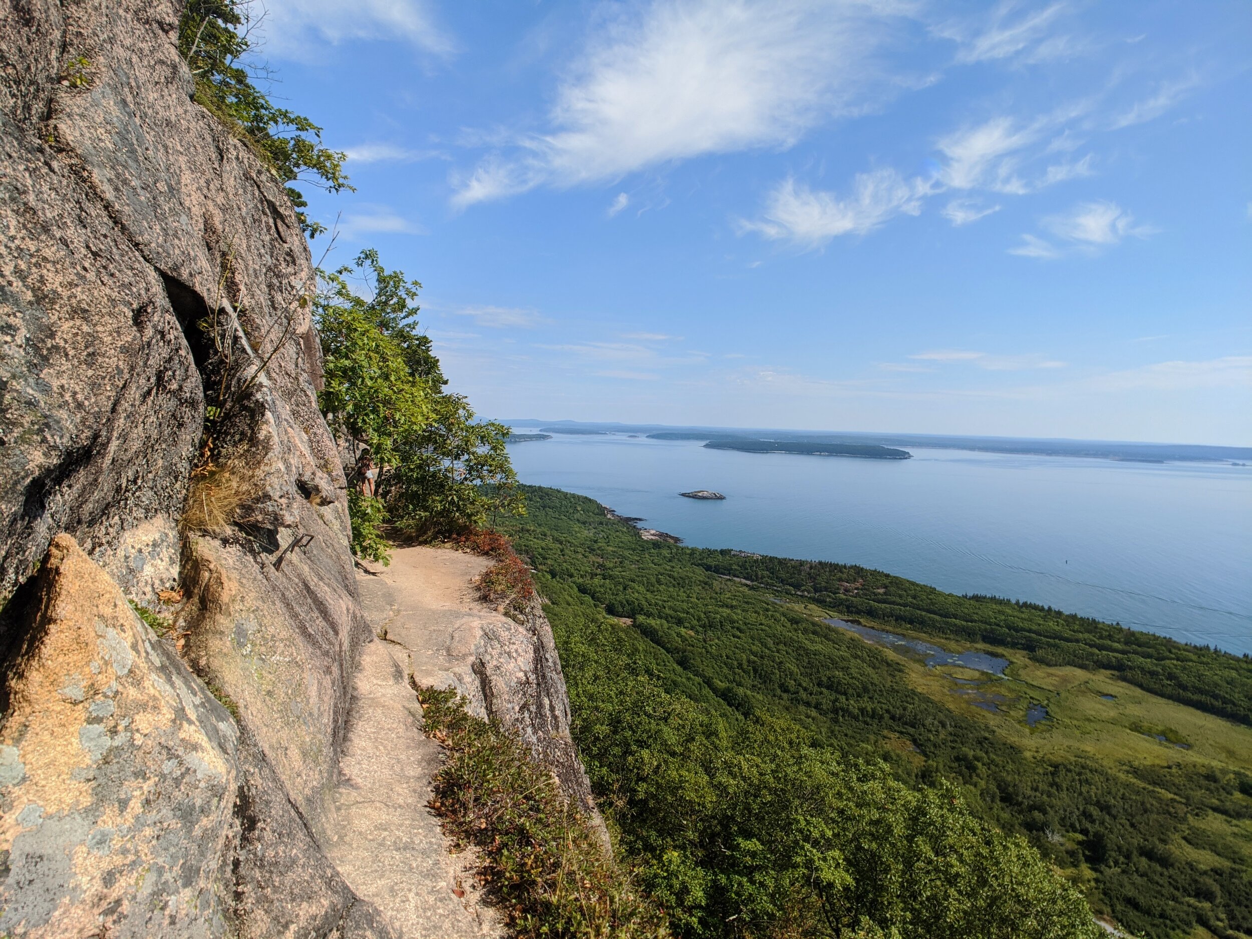
The trail began to hug a cliff as I passed my first patches of snow. There were steel cables bolted into the rock to hold as the path got narrow enough to only allow for one person to traverse it at a time.
It became difficult to tell exactly where I was going as the trail seemed to bend northward around Mt. Whyte. I could see the cliff wall of Mt. Victoria and it’s hanging glaciers in front of me as the clouds cascaded over it.
I assumed I was heading up that way as I couldn’t see much of any other option.
But the trail then took a quick 180 into a series of switchbacks climbing steeply into another forested area.
Part III: The Mountaintop Teahouse
At the top of the hill, the trail opened up to a meadowy area filled with wildflowers and a rocky brook running through it. It was so serene it seemed like something you’d see at an amusement park. Something painstakingly designed to look natural and not painstakingly designed.
There were a decent amount of other hikers up here enjoying the views of the meadow, so I knew I was close. Finally, just beyond the brook, nestled in a protective patch of pines, was the Plain of Six Glaciers Teahouse.

With the snowy mountain landscape and the prayer flags flapping in the wind, I could have easily been convinced I was in the Himalayas. I think that was the vibe they were going for.
I pulled up a chair on the open wooden patio that wrapped around the building and was soon greeted by one of the staff members.
They offered a variety of teas, sandwiches, and a “hot meal of the day” (cash only). The hot meal that day was chili.
With perfect timing as the warmth from the hike up wore off and the chill from the cool mountain air began to set in, my server came by with the hot tea and warm meal.
We got to talking a bit about the history of the place as my nerd side got the best of me.
She told me that the tea house was built by the Canadian Pacific Railway in 1924. It was originally a rest stop and shelter for mountaineers on their way up the continental divide through Abbot Pass. It fell into disuse midway through the twentieth century, but then was bought by Joy Kimbal in 1959 and has been run by her and her daughters ever since.
There is no electricity or running water up at the tea house and everything is made fresh and prepared daily. They are resupplied at the beginning of the season by helicopter and then by horse or on the backs of the staff as they hike the same trail up as guests do for their week long shifts.
As I finished my tea, I asked more about the continental divide up ahead.
In front of us, peaking through the trees, was the peak of the rocky mountain range that divided the North American continent.

The server told me that if I wanted to, I could continue hiking that way for another kilometer or so and get a close look of the Victoria Glacier.
So I did.
Part IV: Getting Up Close with Ancient Glaciers
As the trail wrapped around a hill, it came out of the pine patch and onto a rocky ridgeline. It was considerably more windy up here. Enough that I had to be a bit mindful of my footing.
The landscape was very different from where I was just a few minutes ago. The area ahead was completely barren with only varying shades of grey rock as I stood in the last bits of vegetation. This was the place from which the trail gets its name, the Plain of Six Glaciers. Surrounding me were the hanging mountain-top glaciers of Mount Aberdeen, Lefroy, and Victoria, as well as the Lower Victoria and Lefroy glaciers, creeping into the valley.

These ancient chunks of ice, slowly moving under their own weight, have been here in one form or another for thousands of years. Although in recent decades they have been retreating due to global climate change at unprecedented rates.
The very ridgeline I was standing on was created by the bulldozing terminal edge of the glaciers years ago.
The temperature up here was a bit confusing. Despite there being snow down below at the base of the ridge, when in direct sunlight, it felt perfectly warm. I could feel the heat on my face and through my fleece. But while in the shade of a passing cloud it was drastically colder.
The glaciers seemed to be feeling the same effect. When the sun was shining long enough I could hear loud thunder-like noises as the ice released tension in its summer thaw. These noises, I was warned, were precursors to avalanches, which made it unsafe to get any closer.

I spent a lot of time at this part of the hike. Just sitting there, listening to the noises, feeling dwarfed by the surrounding rock formations, appreciating the foreign feeling of the wintery air in August.
This was my last full day in Banff. I really did not want to leave. But the day was drawing on and the sky was getting increasingly cloudier. With Lake Louise just a far-off blue speck in the distance, I began the trek back down.
I have seen a lot of beautiful and amazing places in my travels, but Banff, you will be hard to top.

Nature is Metal \m/
Hiking Guide:
Here’s a little more info on the trail, but if you are looking to add this hike to your list of adventures, do yourself a favor and go check out Just Go Travel Studios for an in-depth, detailed guide on how to get it done. Good luck and let me know how it goes!
alltrails.com
DISTANCE: 8.6 mILES (13.8km)
Elevation Gain: 1,925 ft (587m)
Peak Elevation 7,222 ft (2201m)
0 miles/km - The hike starts at the Fairmont Chateau at Lake Louise. Get here early as parking fills up quickly. Find the walkway just past the Chateau and follow it along the lakes North edge.
1.5 miles (2.4 km) - You’ll come up close with some climbing cliffs and the glacier river delta.
1.8 miles (2.9 km) - This is where the moderate elevation gain begins and climbs into the forest. It is steady and nothing too steep.
2.9 miles (4.7 km) - The hike begins to hug a cliff wall. Grab onto the bolted-in cable if you are afraid of heights.
3.3 miles (5.3 km) - A short series of switchbacks.
3.5 miles (5.6 km) - Congrats! You’ve found the Teahouse!
4.3 miles (6.9 km) - Abbot’s Pass view point looking into the Plain of Six Glaciers and the Victoria Glacier. Head back down the way you came to get back to the Fairmont Chateau.