Solo Overnight on the Best Hike in NJ
On this Hike:
The best view in all of New Jersey
A picturesque mountain glacial pond
A well maintained, easy to access backpacker campsite

Distance: 10.2 Miles
Elevation Gain: 1,555 ft
I feel like New Jersey gets a bad rap. Growing up in NY, all I knew of the state was what I saw coming over the George Washington Bridge, or the industrialized areas around Newark Airport.
But if you venture outside the Rt 1 corridor, you’ll find this densely populated state has much more of mother nature’s beauty to offer than you’d might expect.
From the famous ocean beaches ‘down the shore’, to the largest remaining Atlantic Coastal Pine Barrens, and of course, seventy two miles of the Appalachian Trail, which thru hikers frequently rate as unexpectedly wild and beautiful. New Jersey has a bit of everything for those wishing to break out of the NYC/Philadelphia megapolis.
Of all of New Jersey’s beauty though, for this cool early October weekend, the Delaware Water Gap area of the Kittatinny Ridge was my target for a quick overnight hike.
Located nowhere near the state of Delaware, the water gap is where the Delaware river has been carving a notch through the Appalachian mountains for millions of years, and serves as the geographic boundary between New Jersey and Pennsylvania.
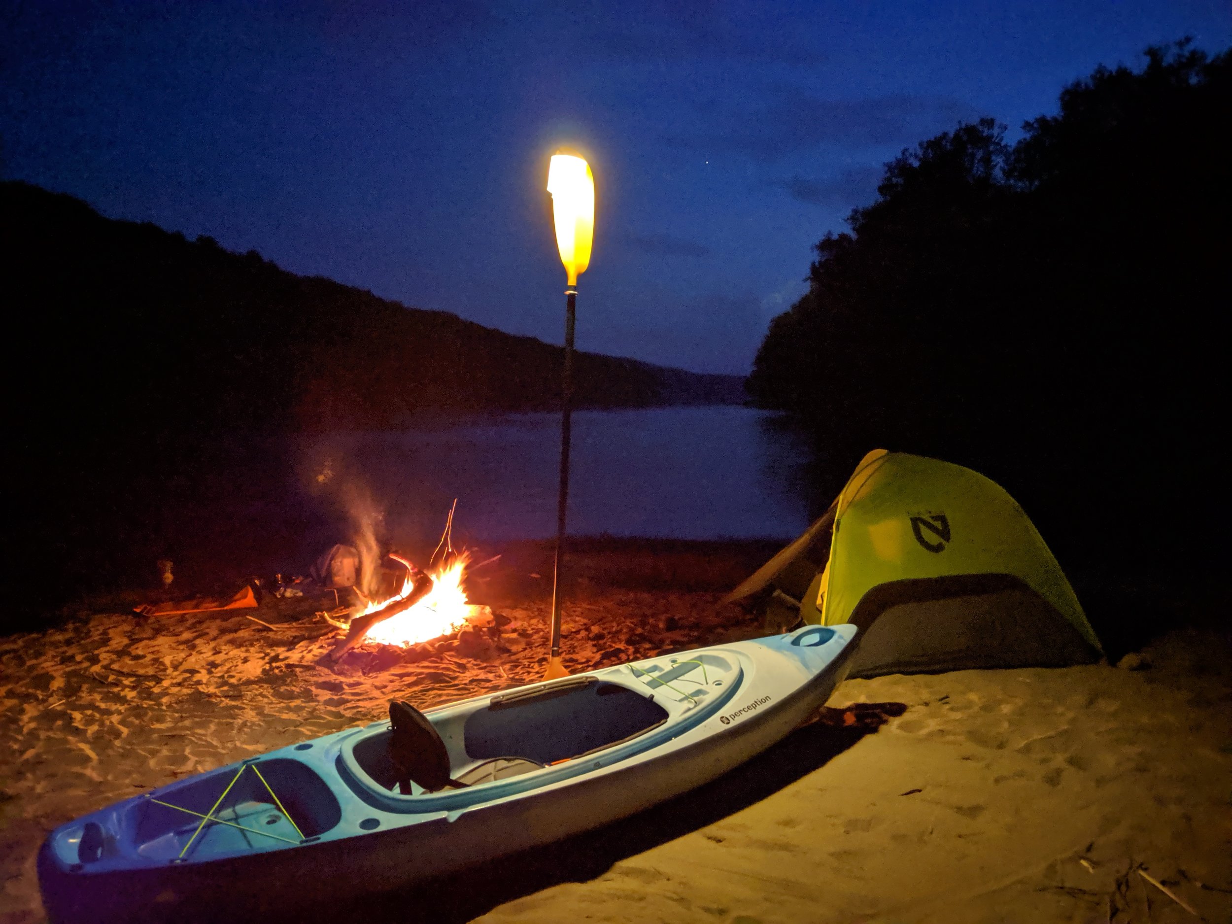
I had ended my previous kayak-camping adventure here in the water gap, so it seemed only fitting I began this adventure at the same location that one left off.
Except this time, instead of heading down river for three days, I would be hiking up Mount Tammany for the best view in the entire Garden State.
Part I: Trekking Up Tammany
This hike is far from being a secret gem, as it is consistently listed among the best hikes in NJ. You won’t have the trail to yourself but the short trek up to the view is worth the crowd.
It is rare to find parking at the actual trailhead unless you get there before 7am. So I headed immediately to the Kittatinny Point Visitor center on the other side of Rt 80. It's a nice area with picnic tables, restrooms, views of Mount Minsi, and a great landing spot for a summer tubing adventure from Worthington State Forest.
I laced up my hiking boots and taped my knees and headed out from the parking lot. I followed signs that guided me under the rt 80 overpass to the trailhead for the Mount Tammany Red Dot trail.
The first mile of the hike is the steepest, and really the only steep part of the whole day. But don’t let the short distance fool you. I would not call this a beginner’s hike.
As I was sucking wind, I realized I may have been a bit more out of shape than I thought. Returning to the classroom full-time had eaten into my gym time. But that was just me making excuses.
Luckily after climbing over some rocky outcrops there was a panoramic view point to take a quick breather from my warm-up.

From here I could see up and down the Delaware River. With Arrow Island in the river to the left, and Mount Minsi directly across in Pennsylvania, this view was stunning enough to have been the objective for the day. But this vista was just an appetizer for what was coming next.
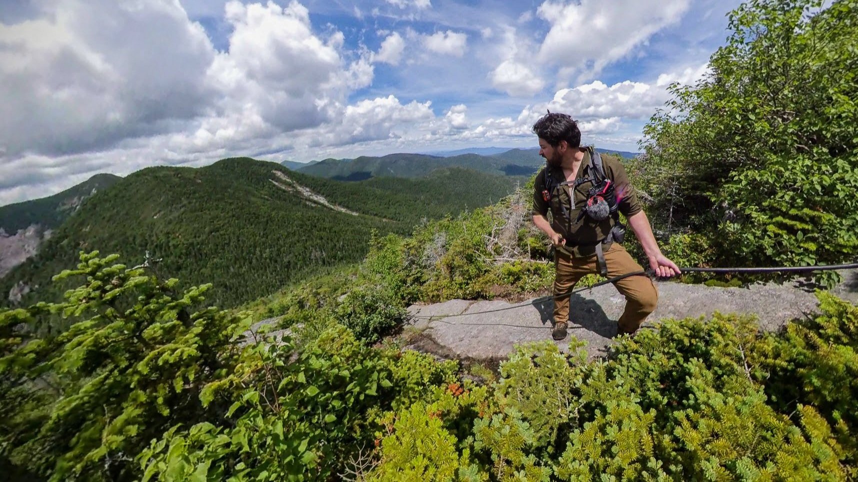
Continuing on, the Red Dot trail leveled off a bit before heading up a very rocky, almost-a-scramble section that served as a bottleneck for my fellow hikers trying to get to the top that morning.
As we all climbed up in a socially distanced line, the hike took on a kind of social dynamic. Each group seemed to encourage each other, or give advice on loose rocks. There was one particular couple of note celebrating a 60th birthday that everyone seemed to patiently cheer on.
And just beyond that, once over the last outcropping, there it was.
At only 1.3 miles into the whole hike, the best view in all of New Jersey.


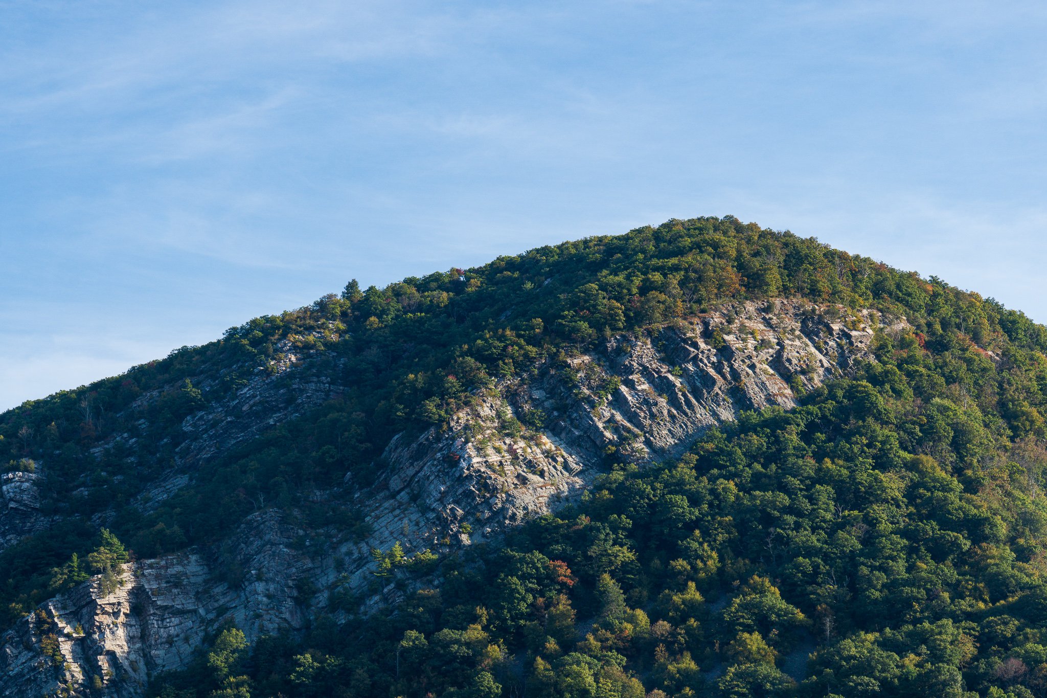
Bonus shot of Mount Tammany from the side of Mount Minsi in PA, taken Feb 2021.
I sat there at the rocky summit of Mount Tammany, for a bit. Slowly and deliberately taking in the view.
While looking out, I began to notice the wildlife that had also found a way to make it up there.
Turkey vultures riding the thermal air currents. Chipmunks doing their own bit of mountaineering. My fellow homosapiens taking their selfies and instagram pics. (No judgment. I am just as guilty)
Speaking of that last animal. This place not only has an interesting geological history, but a human one as well.
Mount Tammany was named after Chief Tamaned (c. 1625–c. 1701) leader of the Turtle Clan of the Lenni Lenape indigenous people who used to call this area home.
Tammaned went by many names and the early English settlers called him “Saint Tammany the Affable”. Known as the patron saint of the Americas, he stood for peace and amity, and was responsible for signing the treaty with William Penn which created modern-day Pennsylvania.

The Treaty of Penn with the Indians by Benjamin West, depicting Penn negotiating with Tamanend
After the Revolutionary war, Tammaned took on an almost mythical status as an icon for the peaceful politics of negotiation. Many states even formed their own Tammany Societies devoted to helping the poor. These societies were responsible for building New York City’s famed Tammany Hall.
Part II: Kittatinny Ridge to Sunfish Pond
Snapping out of the time travel day dream, I picked myself up and left the crowds at the summit.
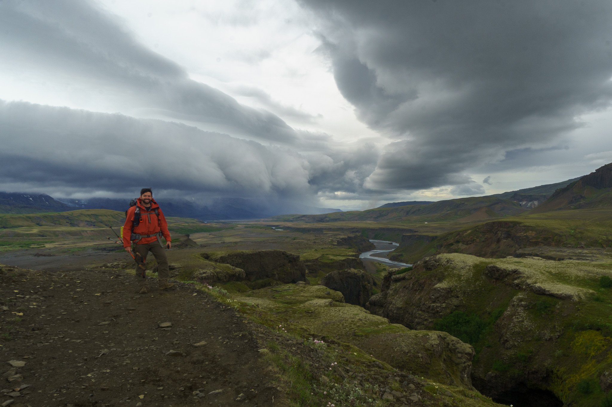
Pushing northeast, the trail began to flirt with the pronounced kittatinny ridge of New Jersey before connecting up with the Blue Dot Trail.
This Blue Dot route heads down to Dunnfield Creek and back out the Rt 80 and is the trail most would take that day. But I was planning on staying the night so I continued on the route less traveled down the ridge.
This loosely maintained fireroad trail continued on for a straight and flat four miles, with the occasional view of Warren County peaking through the branches to my right.
Once I found the easy to miss Turquoise Trail, I turned northwest toward Sunfish Pond.
From this southern approach, I was able to come across the Sunfish Pond overlook giving me a view of the whole of the pond from a vantage point so perfect, I’d believe you if you told me it was man made.

Sunfish is not just any body of water. This 44 acre pond was formed 18,000 years ago as a glacier tore a 60 ft deep hole in the ground as a last goodbye to Jersey as it retreated north, signalling the beginning of the end of the last Ice Age.
As Bill Bryson puts it in one of my favorite books, “A Walk in the Woods”:
“For northbound hikers Sunfish Pond is something of a glorious novelty, since nowhere south of here will you find a body of water on a mountaintop. It is in fact the first glacial feature northbound hikers come across. During the last ice age, this was about as far as the ice sheets got. The farthest advance in New Jersey was about ten miles south of the Water Gap, though even here, where the climate would let it go no farther, it was still at least 2,000 feet thick.
Imagine it—a wall of ice nearly half a mile high, and beyond it for tens of thousands of square miles nothing but more ice, broken only by the peaks of a very few of the loftiest mountains. What a sight that must have been”
The water chemistry of the pond is unique to the area allows for only a few hardy species of fish to survive. To protect its sensitive ecosystem, swimming and camping in the immediate area is prohibited. Which is a shame really, because, damn. What a peaceful view this would be to wake up.
Coming around the bend of the pond and turning Southwest, I linked up with the 2,000+ mile long Appalachian Trail. The route on this side of the pond was extremely rocky and I had to do some minor boulder hopping while attempting to maintain my balance on loose rocks.
Before leaving the area I took the opportunity to fill up my water from a cascading stream from the Sunfish overflow.
A half mile further, I finally made it to where I would be setting up camp for the night, backpacker site 2. (Backpacker site 1 no longer exists).
The area was well maintained, and had plenty of spots to set up a semi-private camp site. Far from being a wilderness area, the campsite had two privies, bear boxes, and even a ‘ridge runner’ park ranger camping up there to make sure hikers adhere to leave no trace practices and don’t get too rowdy on busy weekends.


New Jersey is a very populated state, so I appreciated the extra effort to preserve some of its natural beauty.
So I found myself one of the few remaining nice quiet spots among ferns and began my setup routine and settled in.
Being so close to home and a hike I have done many times before, I was very comfortable in planning this weekend outing. Perhaps a bit too comfortable.
I got complacent.
As I was unpacking my food bag, I realized I had neglected to pack my spork.
Shit.
How does one eat pasta in meat sauce without utensils?
I sat and thought about my options.
I could use my hands. That would be messy, unenjoyable, and would be difficult to get the smell of food off me. I would become a beacon for bears wanting to chowdown on a human in a sleeping bag burrito. That was off the table.
I could just not eat. Safer, but also very much not enjoyable.
Then bam! An idea struck. I took two tent stakes back out of the ground, washed them as best I could, sanitized them in boiling water, and created tent-stake chopsticks.

Sanitizing Tent Stake Chopsticks
It actually worked out pretty well. Improvise, adapt, and overcome.
After dinner, I hung the food bag, and witnessed the sky turn from pale blue to pinkish-orange.
I crawled into my tent and watched through the mosquito net as the stars lit up one by one in the ever darkening sky, listening to my audio books until my eyes could no longer keep themselves open.
Part III: The Easy Way Out
I like this backpacker site.
It is only three miles from the trailhead so it makes it the perfect spot for a quick weekend night getaway in nature that doesn’t require the extensive planning that adventuring through a wilderness area would.
This was actually the location of my first solo overnight backpacking trip years ago. And is still my go-to spot that I like to take newer adventures looking to backpack camp for the first time, or where I like to go to try out new gear in the field before a big trip.

But now, like many times before, it was time to go. So after my morning coffee, I packed up and started my slow three mile slope back down to the Water Gap.
The descent was steady and welcoming with a forest floor full of ferns waving in the wind as I walked by.


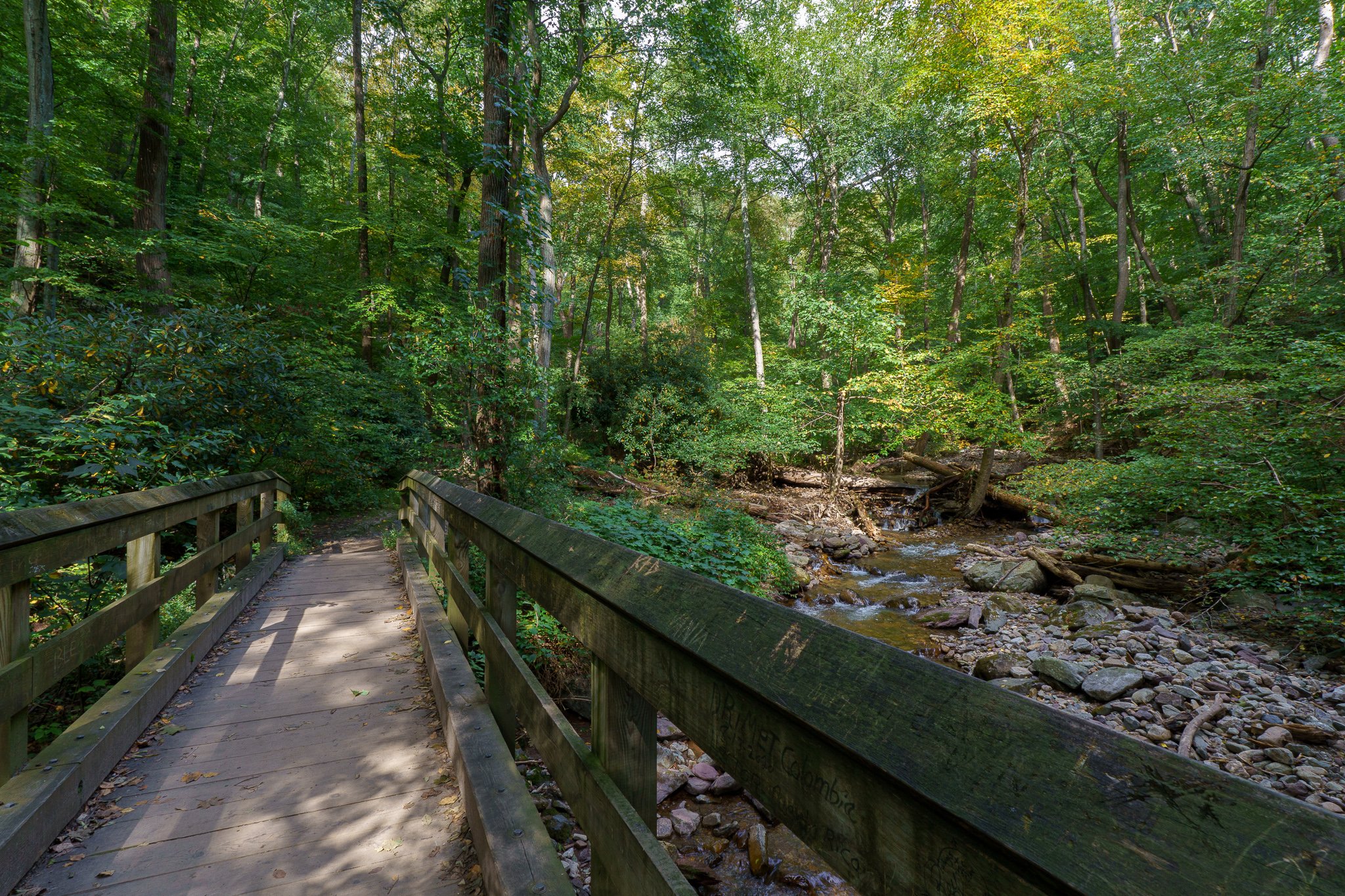
In the last mile, I could begin to hear the rushing of water as I was approaching the scenic rhododendron-strewn gorge of Dunnfield Creek.
Finally, I came to the wooden bridge creek crossing to the Mt Tammany parking lot.
From there I crossed back under the Rt 80 overpass returning to the Kittatinny Point Visitor center and ending my quick solo one nighter October adventure.