Four Days Across Iceland
The Laugavegur (Laga-vay-gur) trail is a 55 km/34 mile multi-day trek, that flows through the Icelandic wilderness.
This trail had the most unique and varied landscapes I had ever seen on any adventure. Throughout the 4 days it took to complete, the scenery shifted between rainbow striped mountains, highland snowfields, black sand deserts, and green moss covered mountains.
Each day had non-stop breathtaking views. It is easy to see why National Geographic ranks it among the world’s top 20 hikes.
Getting there:
Flying to Iceland from the US’s east coast is a relatively cheap 5 hour flight. Landing at Keflavik international, I hopped on one of the many buses run by ‘Flybus’ for a 45 min ride into Iceland's capital city, Reykjavik. I arrived early in the morning, before check-in time, so I was able to explore the downtown area a bit.
Reykjavik has a unique vibe. Part old-town Europe, part hipster Brooklyn. With its mix of new and old architecture, murals, and endless restaurants, it’s a city I wouldn’t mind getting lost in.


I found myself at Grái kötturinn for breakfast. A small hole in the wall, with probably the best coffee I had all trip. One thing to note: although it’s cheap to fly to, I found the food in Iceland to be much more expensive than what I was used to.
After exploring for a bit more, I checked into the Hotel Odinsve and rested up for the big adventure the next morning.
Day 1: Landmannalaugar to Hrafntinnusker
12 km (7.45 miles)

The BSI bus terminal was a quick walk from the hotel. There I was able to hitch a ride with Reykjavik Excursions on one of their highland busses for a trip into the country’s interior.
It took us four hours to get to the Landmannalaugar Highlands. But when we did the weather was sunny and warm.

Historically, hundreds of years ago, the valleys surrounding Landmannalaugar had been avoided by sheep herders due to the alleged presence of evil spirits. Any sheep that wandered into these valleys were abandoned and given up for lost. It wasn’t until 1852 that the area was explored and mapped, lifting the shroud of mysticism.
Today it is the gateway to the world famous Laugavegur trail, bringing together many like-minded adventurers that are brave enough to take it on.
Getting off the bus, the first thing that stood out was the Mountain Mall. Made from two green busses, it’s a good place to stop for any last minute or forgotten items like rain gear, first aid supplies, and snacks.

They also sold forms of entertainment, or as they put it, “To avoid boredom in rainy days, our customers can buy postcards, candles, playing cards, and condoms.”
I knew this first day was going to be the most physically demanding of the trek, so I decided not to linger and started immediately.

Courtesy of the Camp Warden at Álftavatn
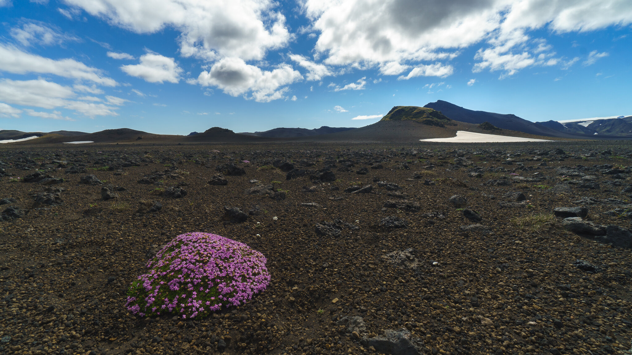
Most of day 1 was spent traversing the Torfajökull Caldera, a huge 15km wide crater produced by a large and violent volcanic eruption.


It’s last eruption was in 1477, but is still geothermically active with hot springs and small geysers throughout.
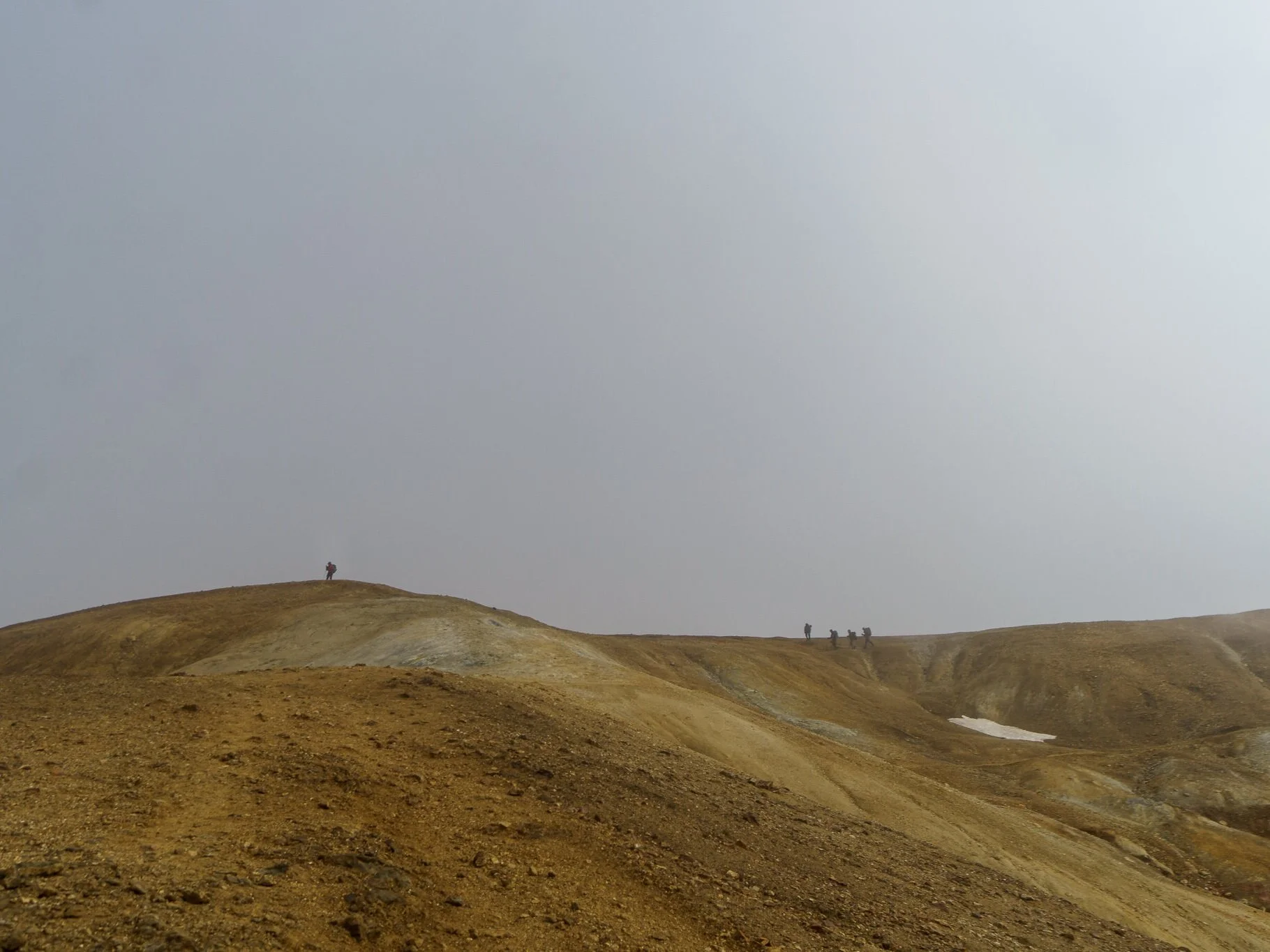
After two miles of jagged lava rock, the trail climbed into rolling hills of painted mountains.
It was here I traversed my first bits of snow. More than I was expecting in July at this elevation.

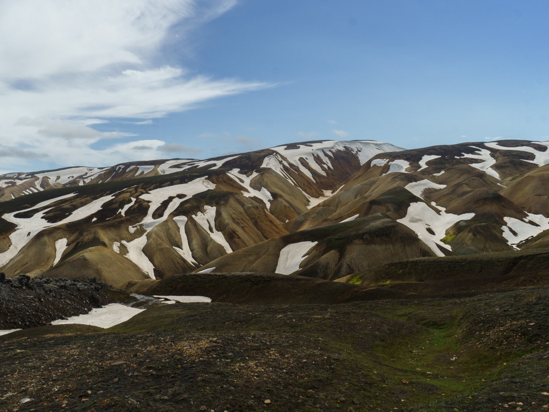

After a bit of climbing, I settled on a plateau where I was able to see the Torfajökull glacier in the distance.
Most immediately in front of me was the Stóriher hot springs. These springs seemed to guard the entrance of the highlands with their sulfur-smelling mist.

Kept warm year round, the hot springs created a tiny oasis of mossy vegetation in an otherwise barren landscape.
From here, there was a steep climb out of the small valley and into the vast highland snowfields.
The weather at this point was a bit bizarre. There I was, with snow at my feet. Yet I was perfectly warm hiking in a t-shirt. I can’t explain it, but with the direct sunlight on me, I was absolutely fine.


That sunlight did not last long though. As a sudden fog set in, it became difficult to keep the trail ahead of me and I began to lose my bearings.
But then, peaking through the fog, I found the next trail marker. This particular trail marker happened to be a memorial to a hiker who died out here in a sudden summer blizzard.

Okay, “yay” not lost, but not the best omen.
It was a sobering reminder that weather can turn on a dime in the mountains and not to play dice with mother nature.
As a backpacker, when it comes to gear, it’s a constant struggle between “every ounce counts” and “better to have and not need, than to need and not have.”
For this particular trip, I made sure I was prepared for any change in weather, despite the weight. I was glad I did.


The biggest chunk of obsidian I have ever seen. (Dragon glass to those Game of Thrones fans)
A cold front set in, blasting me from over the ridge ahead. I continued on and spotted a beacon atop a hill marking the way to the mountain first mountain hut.
The trail has a handful of these mountain huts. For a small fee you can reserve a spot in them for a hostel-like bunk sleeping arrangement. Or for a smaller fee set up your own tent in the surrounding camping area. I went with the latter.

The weather that night was less than optimal. The wind was aggressive, roaring through the valley like something those alleged evil spirits would be all about.
As my sympathy for those superstitious sheep herders grew, I surrounded my tent with a wall of rock in an attempt to break the wind.
At the highest altitude on the trail and covered in snow for most of the year, this is unlikely to be the place you want to camp unless you have experience and specialized equipment. If I were to stay in a hut at all this trip, this is where I'd do it.
But I had my shelter, and plenty of bad weather experience in the Marine Corps to draw on. So to avoid the snores of other close quarters hikers, I'd risk it with nothing but a thin sheet of nylon protecting me from the elements.

Day 2: Hrafntinnusker to Álftavatn
12 km (7.45 miles)

The wind did not let up all night. If you can call it 'night'.
The summer sun never really sets in Iceland. It flirts with the horizon for a bit, before changing its mind and turning back.
This took some getting used to. Wearing an eye mask was necessary if any attempt at sleep was to be made. Still, it was a bit disorienting to peek out of that mask at 3am to check the time, only to be blinded by what looked like mid-day sun beating through the tent walls.
Eventually morning came. Or did it? 5am, 2pm, it really didn’t matter with this sun. As long as I got 7-8 hours of sleep, I could start and end my day at any time.
Still, I think it was morning.
The high winds brought low visibility with near white-out /inside-of-a-cloud like conditions. Although the wind was heavy, the rain was light with a sideways misting spray.
For the first few hours, I slogged through a constant uphill/downhill pattern, barely seeing what was in front of me.
I passed another trail marker memorial, this time written in Icelandic.

Every so often the fog would lift for a few seconds and reveal these behemoth snow formations and mountains.

For a sense of scale, a house could fit under that glacier-like snow drift.
It was beautiful. But also kind of unnerving in a way. Like the fear of swimming in deep ocean, surrounded by the dark abyss and incapable of seeing what lies just beyond you. Thalassophobia I think it's called.
The trail led me down a path near a series of ice caves. I had never seen anything like it. Warm geothermal water running underneath dozens of feet of snow had created this network of caves.
I decided that this was a good spot to rest for a bit and refill my water bottles with the melting ice water.

As the day went on the snow cover began to dissipate and the highlands shifted to bright sand colored mountains speckled with lava rock.

And then, as if on cue, while descending scree covered switchbacks, the clouds parted to reveal the most Lord of the Rings-esque landscape I had ever seen in my life.
I stopped dead in my tracks and let out an involuntary, “...wow.”

I wish these photos could do it justice. The bright green valley, punctuated by peaks and accented with undulating streams.
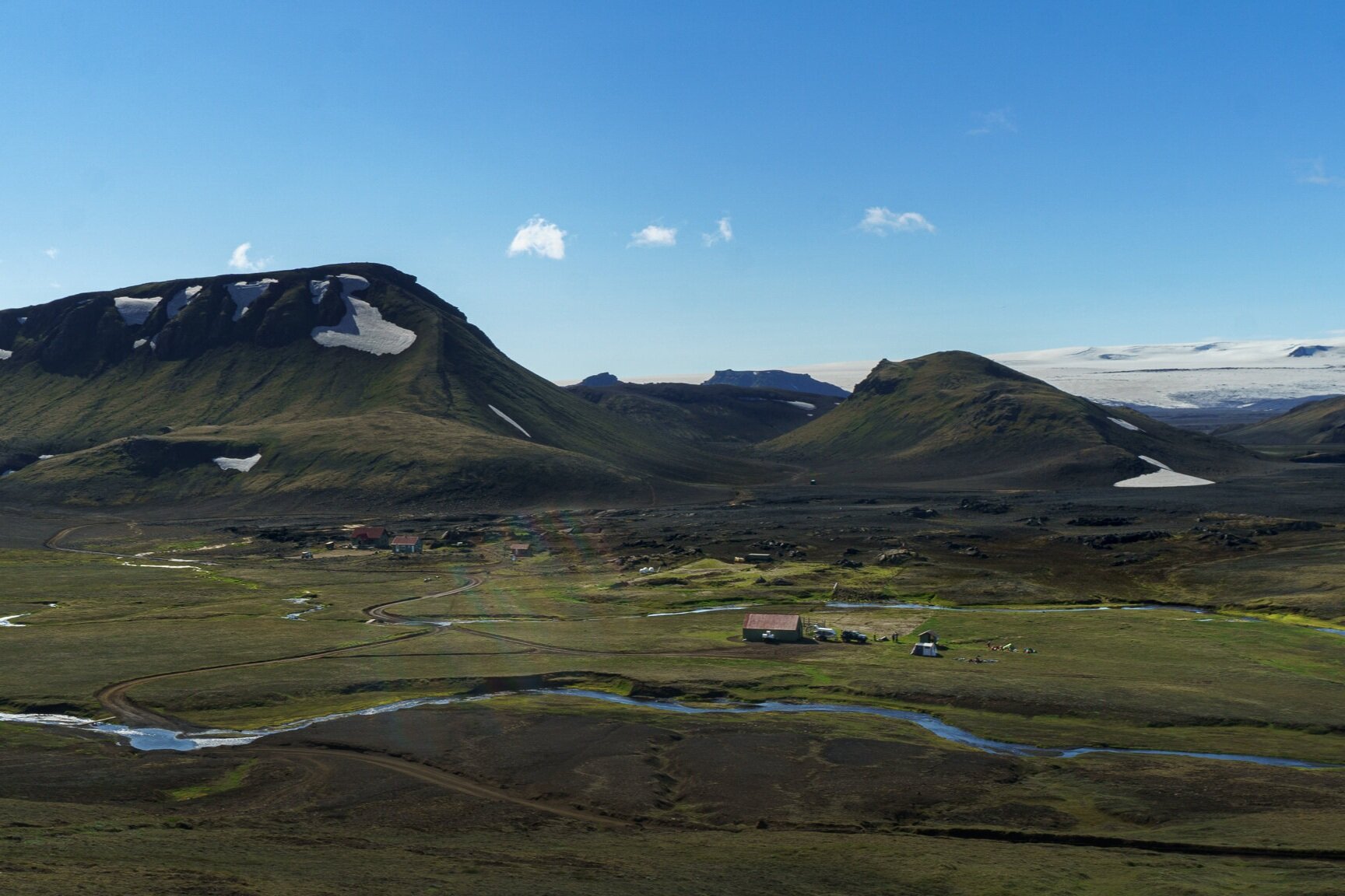
Off in the far distance, ahead to the left, I could see my planned campsite on the shores of Álftavatn Lake. Though it would still be a few hours before I got there.
I continued the descent into this unreal valley where the air became noticeably warmer and less windy as I came to my first river crossing of the trip. A small one, but one that required taking off my boots and doning my river shoes nonetheless.
In the past, I had forded water crossings barefoot on smooth river rocks. But for this trip, on these sharp lava rocks, I heeded the advice given by geologist Brian Zimmer in his trail guide.
“Do not cross barefoot! Shifting rocks can crush an ankle or remove a toenail. When crossing rivers, you should put on designated “river shoes”. These shoes can be old sneakers or strap-on sandals. Flip flops will be torn from your feet and end up deposited in the North Atlantic.”
After the crossing it was a flat two and half clicks (1.5 miles) to the Álftavatn Mountain hut and camping area. This particular hut offered warm showers and hot food. Though I was content setting up camp by the stream and feasting on my backpacker meal. It was chili mac night, after all.


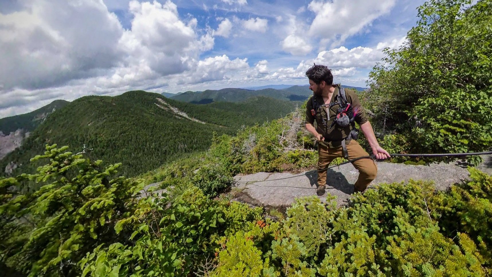
Day 3: Álftavatn to Emstrur-Botnar
15 km (9.3 miles)

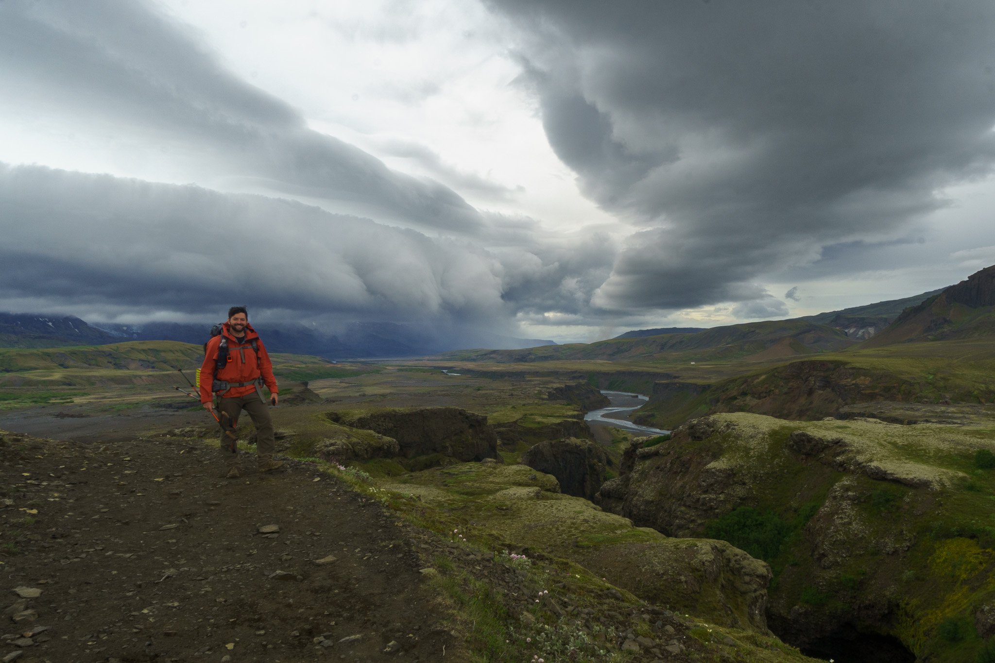
The second ‘night’ was far more enjoyable than the first. Waking up, I came out of my tent to sunny blue skies and clear views.
I knew this third day was going to be a bit longer than the previous two. But also flatter without much elevation change, so I decided to take my time enjoying the morning weather with a second cup of camp coffee.

As soon as the day’s hike began, my senses were assaulted with beautiful views all around me. It was almost too much to handle.
It’s an interesting thing hiking in this wide open landscape. I’m used to hiking in forests where you pop out of the treeline every once in a while to stop and enjoy the scenery. The cool thing about there being no trees is that the views stay with you all day.

I did a lot of planning in preparation for this trip, but there was one thing I had not considered. Where do you pee? Okay yeah, the mountain huts have restrooms. But for a midday bathroom break? There are no trees to hide behind. Just wide-open openness.
I was able to solve that problem with a bit of exposure. To weather and the indecent type. It was a bit awkward, as I hoped the hikers a few miles ahead of me didn’t have binoculars. So I encourage any non-standing pee-ers to especially take note here and plan ahead.

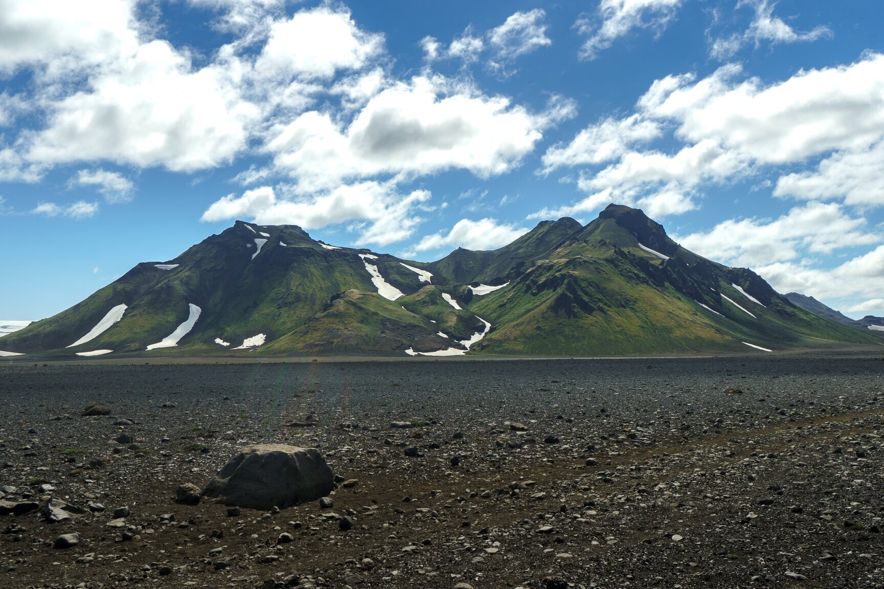
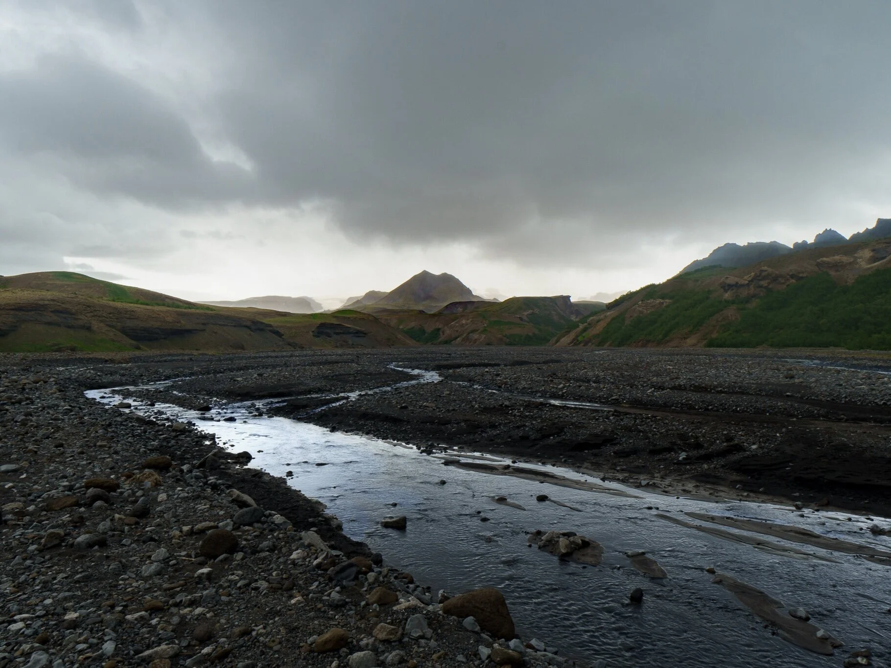
After another wide but shallow river crossing, the landscape entered a period of transition.
Up until that point, the trail had taken me through lush green mossy fields. But from here on out, the rest of the day would have me traverse through a volcanic black sand desert.
Situated at the leading edge of that transition line was the Hvanngil mountain hutt. At 5km south of Álftavatn, it could serve as an alternative campsite if that one is packed or too windy.
Snaking around Hvanngil, the trail took me through a well formed lava flow before bringing me to the intimidating (in both strength and pronunciation) Bláfjallakvísl River.
This was the most difficult river crossing of the trip. It was thigh deep, fast flowing, and blisteringly cold.
I found the best way to cross was to face the current and side step rather than walking straight across. As with each step, the river tried to knock me over and take me for a ride.
I should mention that with all these crossings it is best to unclip the hipbelt on your pack so you can easily ditch it in an emergency. This way it does not weigh you down and keep you face down in the water.
Drowning in a river tends to ruin the trip.
With that mini-adventure over, I dried my beet-red freezing cold feet, and continued on through the wide-open desert.

The desert was littered with varying shapes of basalt rock. These rocks formed from violent lava plumes exploding out of nearby volcanoes. As the molten globs flew on their ballistic paths over the plain, they cooled somewhat before slamming into the ground. The relative amount of cooling of each glob prior to impact is reflected in the varying shapes of each rock.

The day warmed as the hours went by. It was bizarre to see the waves of heat coming off the sand in the distance with snow and glaciers just beyond them.
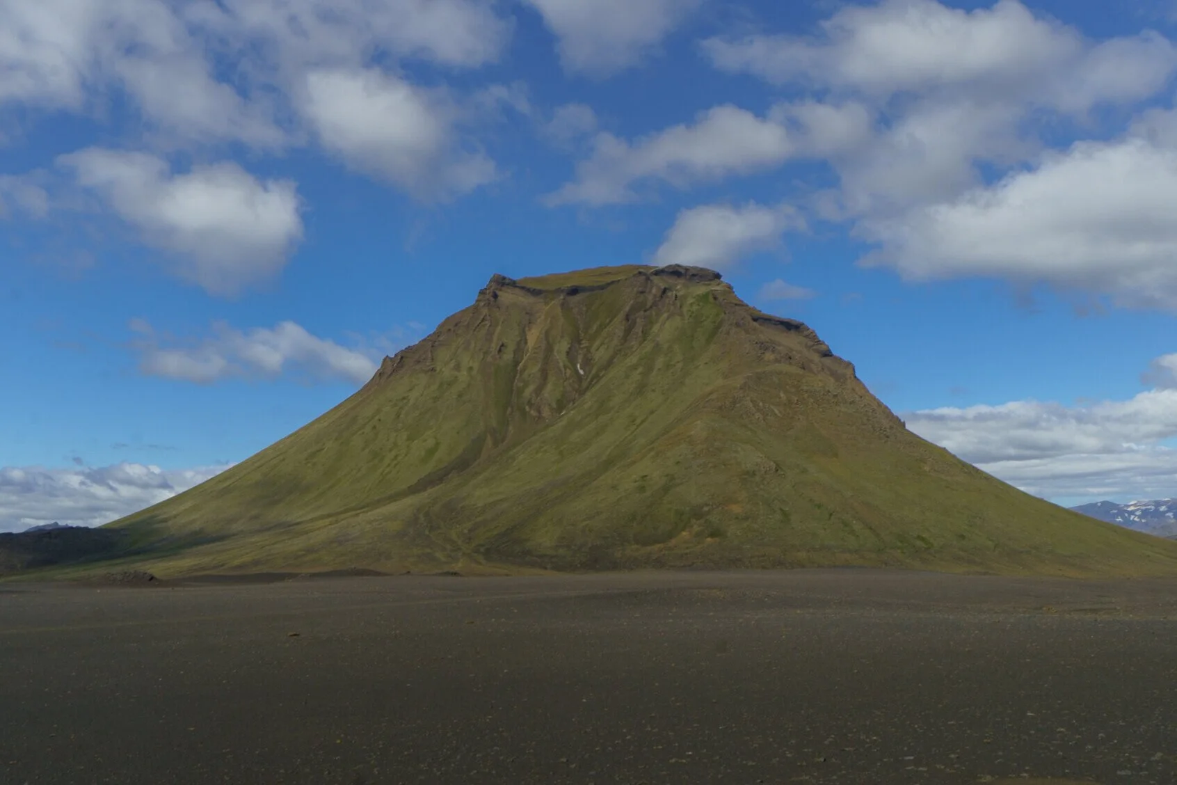
This section of desert comprised of two open areas connected by a valley between these unreasonably photogenic mountains.


As the trail went on, it got less rocky, until finally, it descended into the cool valley oasis that was the Emstrur-Botnar hut and camping area.
It was a little more tightly packed than the others. And I think that fact lended itself to what I experienced that night.

You can only camp at designated sites on the Laugavegur Trail. So despite barely seeing anyone during the day, all hikers tended to congregate at these mountain hut camp areas at night.
Full of colorful tents, colorful personalities, and the quiet murmur of dozens of languages, by the 3rd night of the trek, a sense of community began to form from seeing the same people each night.

That’s Chris’s tent in front of me. This was his second time hiking the Laugavegur trail. He was from Minnesota. And he sounded like it.
Day 4: Emstrur to Botnar to Þórsmörk
15 km (9.3 miles)

I woke up early that morning. So I quietly started my day as the camp became more and more active around me.
I had a bus to catch at the last mountain hut, so I didn’t take my time that morning. In part because I knew I would be taking my time later through the day taking photos and recording footage.
The start of the day’s trek was similar to the end of the last. Not quite out of the desert yet, there was a bit more sand before coming to a steep descent into an amazing river gorge. And that’s when the landscape took a dramatic shift.


The trail descended into it, leading to a bridge inside of the small canyon.
The landscape got greener as I went, with each hill providing a view more amazing than the last.
Off in the distance I could see some nasty weather forming, but it made for some amazing photos.

Four days removed from the Landmannalaugar highlands, the sand became more beach-like as I made my way south.

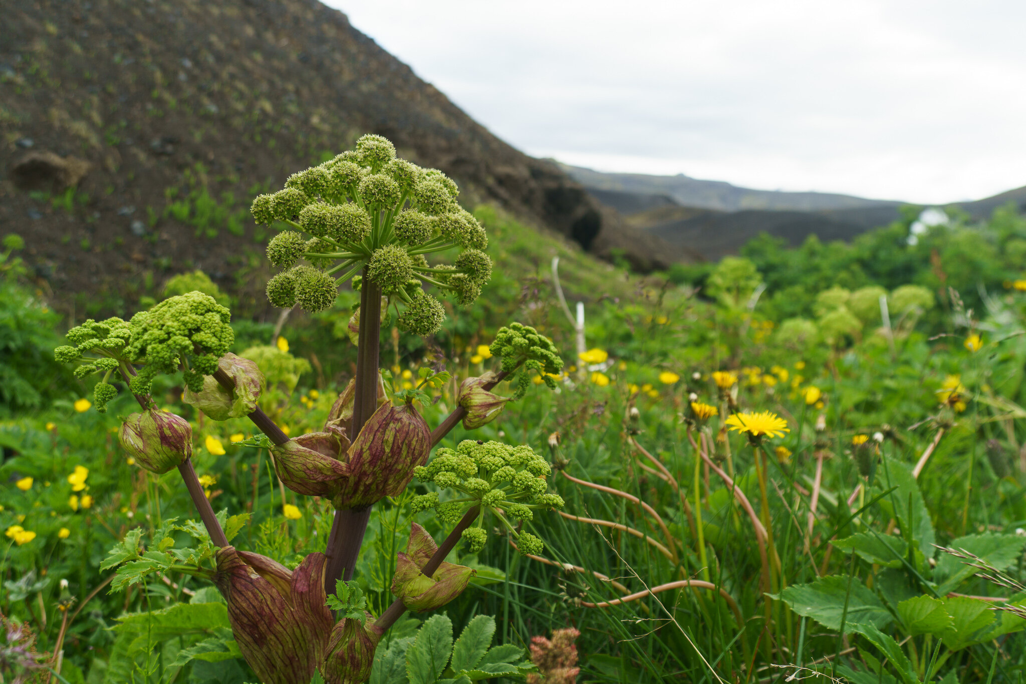
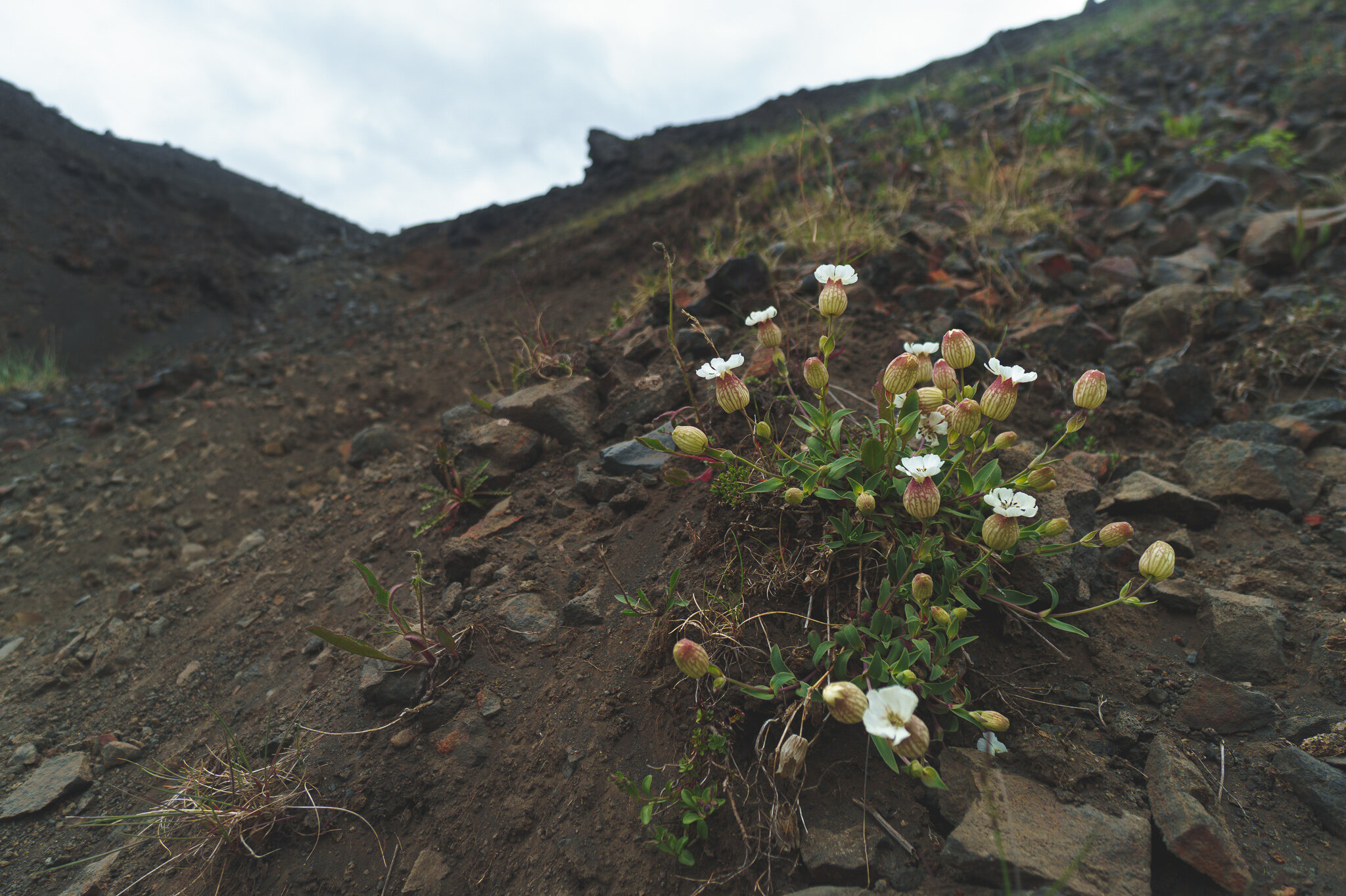
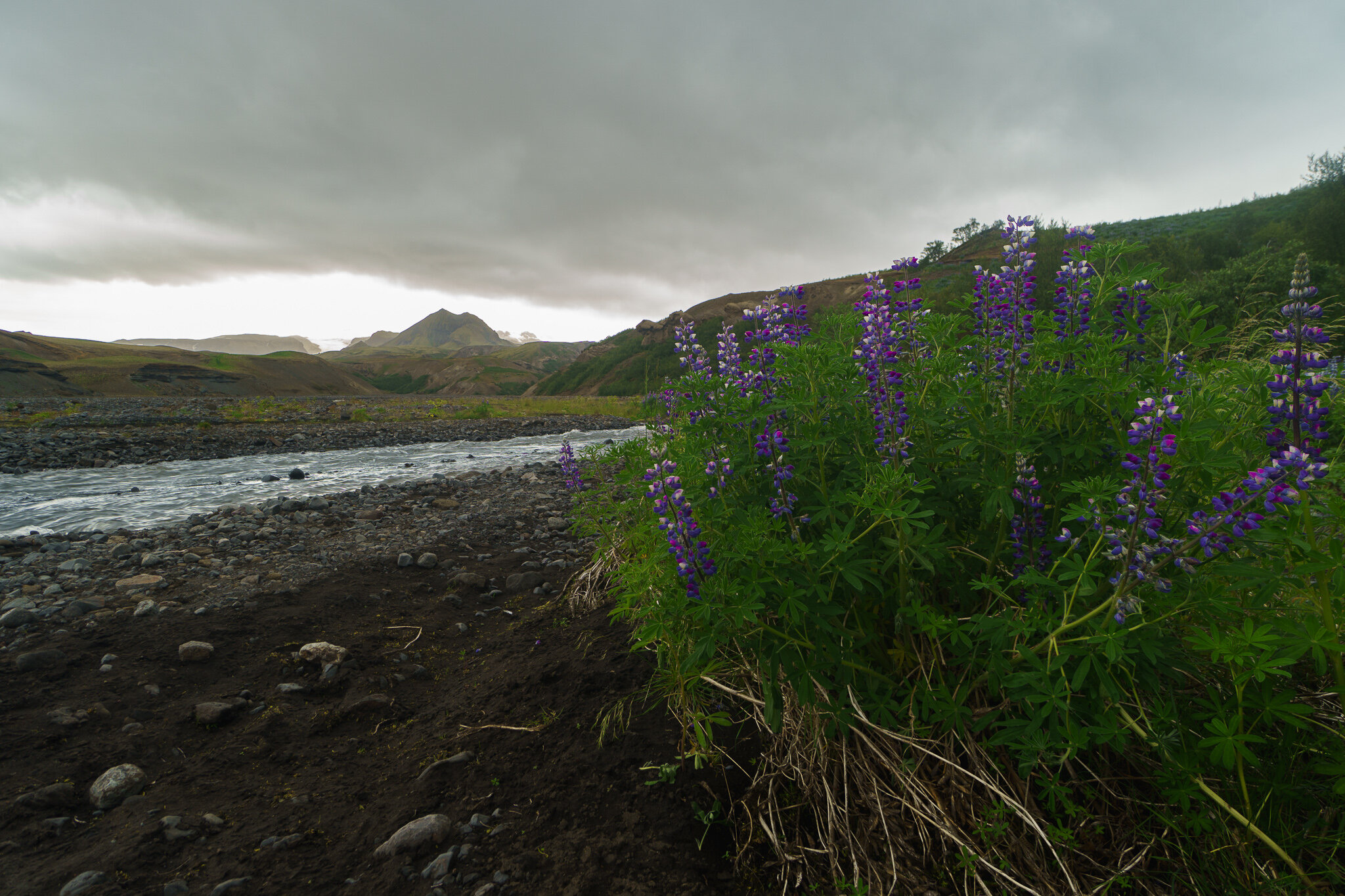
I took note of the exotic plants on this hike. The purple Arctic Thyme, Blue Lupine, the starburst-like Angelica plant. But also found it interesting to see the same familiar clover and dandelions growing here on this far-north remote island.
As the day went on, the rain came sporadically, though never too heavy.
The interior of Iceland is pretty devoid of animal life. At least compared to what I was used to. So it surprised me when a small brown and white spotted bird got my attention by chirping and walking a few feet off the trail alongside me for a while.
He was probably hoping I had some food to drop. Sorry I had nothing for ya little buddy. But I was glad for the company, however brief.
After one last hill to climb, I came to the final river crossing of the trip. This one wasn’t as deep as yesterday’s, but much wider with several sandbar break points. There was a guided group ahead of me taking off their boots. I figured I might as well hang back and watch where the guide decided to cross and follow suit.
As we were all drying off our feet, I struck up a conversation with the Icelandic guide. He seemed surprised I was out here by myself and unsupported.
As it turns out, many people hire a guide to take them through the hike and have their gear jeeped up to each hut. That explains the oddly small packs I was seeing on a lot of hikers.
He asked about the GPS communicator/emergency beacon I was carrying, and was shocked to learn I stayed in a tent that first night up in the mountains at Hrafntinnusker.
It seemed as though he was vetting me a bit with his questions. I didn’t mind. I’m sure he has come across his fair share of hikers in way over their heads, potentially over-burdening the local search and rescue services.
He ended the vetting with, “Well, you seem to know how to read the land, and know what you are doing”. We then talked about camera gear, movies filmed in Iceland, and joked about how horrible the views were in his country. I found Icelanders to be pretty fond of sarcasm.
I’m not gonna lie, as a professional-amatuer adventurer, it felt good to be vetted by a professional-professional adventurer and pass.
Just beyond the river crossing, I entered Thor’s Woods, or Þórsmörk in Icelandic (pronounced Thorsmork).
It’s weird, the things you don’t realize you miss. As I entered the woods and saw the first trees I had seen in days, I got a little excited.
Following a few turns of a dirt road, I finally made it to the Þórsmörk volcano huts with about an hour to spare. There were many other hikers drying off inside. The place had an air of exhausted celebration.
I peeled off my rain gear in tired relief, and grabbed a bowl of potato and lamb soup.
With a proud smirk on my face, I sipped on my soup of champions as I watched the rain gust against the window, waiting for my ride back to Reykjavik.