Exploring The West Virginia Wilderness


The Dolly Sods Wilderness of West Virginia has two distinct climate zones. The high rocky plateau, filled with grassy meadows, and a lower wooded area, lush with rhododendron filled forests.
Named for an 18th century German homesteading family, the Dahls, and a term for a patch of mountain top meadows. The ‘Dahl Sods’ over time came to be known as the Dolly Sods.
During WWII it was used as an artillery training ground. And even 70 years later, it is not unheard of to stumble upon unexploded ordnance. If you do so, mark the spot, with a GPS if you can, and alert the local Forest Service.
Transitioning from a place for explosives to exploration, Dolly Sods is now a protected Wilderness Area with 47 miles of trails to explore.
Over the course of the next three days I would attempt to traverse roughly half of all those trails.

alltrails.com
Day 1: Muddy Meadows and Rocky Ridges
I had been keeping an eye on the weather for a few weeks. Once a 3 day window of manageable meteorology came up, I packed up the Jeep and headed out for Appalachia.
After a long drive, I parked on Forest Road 75 and set out on foot heading West on the Bear Rocks Trail.
From the trailhead, I had a wide open view of miles of meadows before me. As I hiked, I watched the shadows of the clouds slowly glide across the rolling hills.

After a mile of meandering West, I came to a small running creek. I knew this was going to be the only water source until I got to camp that night. I decided to top off my water bottles and ‘camel up’ as much as I could. Today was going to be a very hot day exposed to the sun in the high meadows.

As I continued on, I was excited to see what seemed to be a nearly infinite number of blueberry bushes along the trail. But was then disappointed when I didn’t find a single berry on said bushes. I guess blueberry harvest season comes to these hills a bit later than what I was used to.
It’s a shame really. There are few things more satisfying than foraging your own berries while backpacking.
Just make sure you are 100% positive of what you are picking.
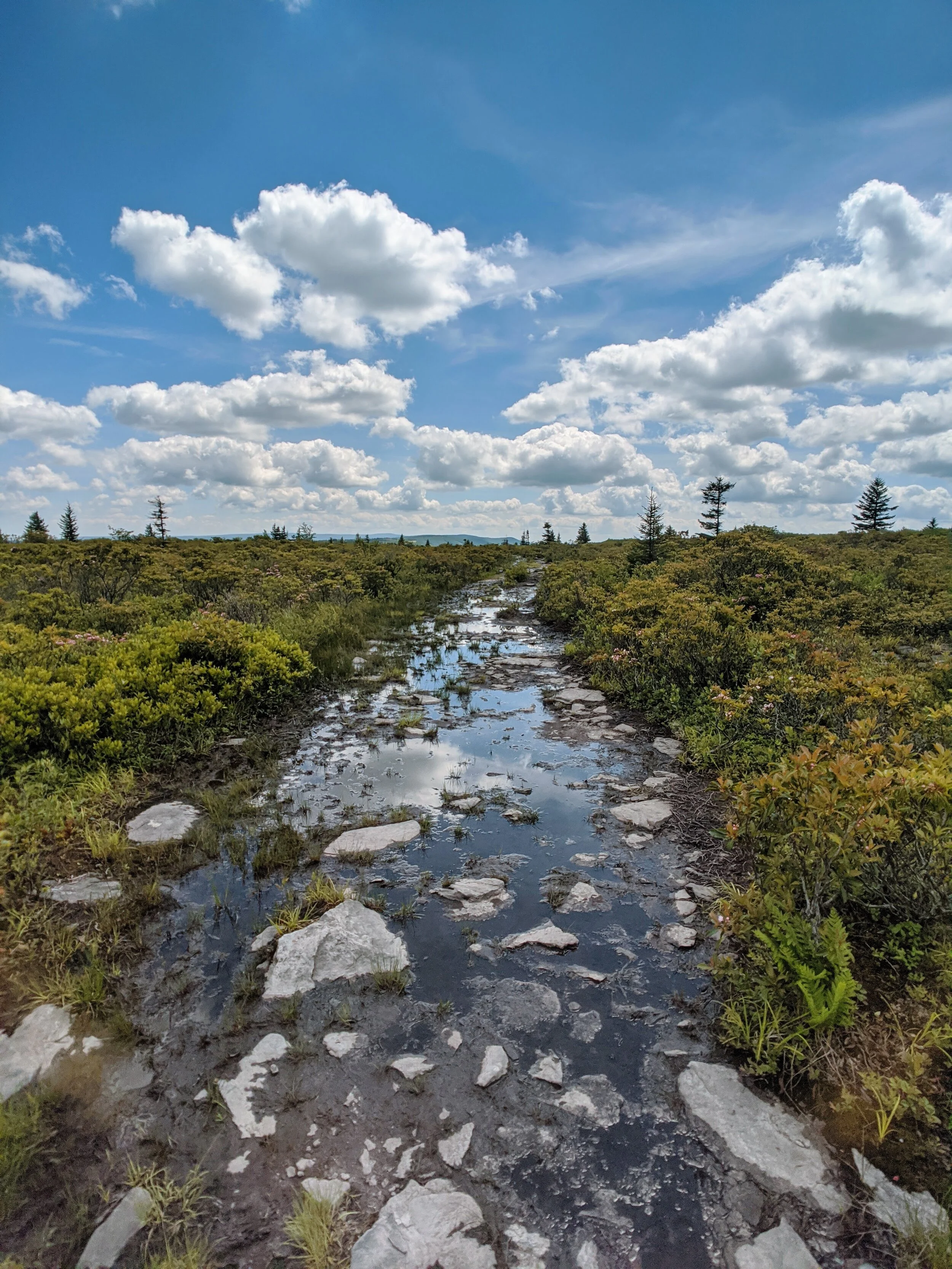
I mentioned earlier that this area had 47 miles of ‘trails’. I use that term loosely. A lot of these paths seemed to be nothing more than intermittent waterways. And after a week of rain, they were nothing but mudways.
I tried to rock hop and detour around as much as I could, but a lot of it was ankle deep and unavoidable.

This of course slowed my pace down significantly.
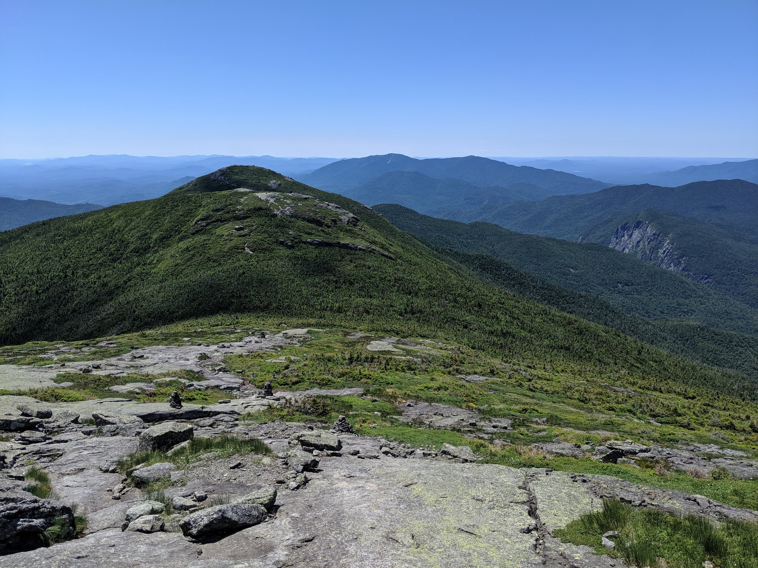
At around 4 miles in, I turned South onto the beautiful Rocky Ridge Trail. I was greeted with amazing open views to the West, and massive wind-carved limestone formations in front of me.
For the next three miles I found myself walking along and sometimes scrambling up this ridge.


This type of landscape is rare in Appalachia. If I didn’t know any better, I could have mistaken it for areas much further North in Canada.

The wind up here was fierce. And judging by how the trees had grown with it, this seemed to be the norm up on this ridge.
As I took in the serene beauty around me, I began to think about which I enjoyed more and why, National Parks or Wilderness Areas.
A National Park is a protected area designed to bring people to the most amazing landscapes this country/this planet has to offer. To do that, however, that means building roads, structures, bathroom facilities, etc. These parks have unparalleled scenery, but because of this, they have a tendency to get crowded with tourists in the peak seasons.
A Wilderness Area on the other hand is a protected area of land that is, for the most part, untamed by humans. That means no roads, no motorized vehicles, and no permanent structures.
To explore these areas, you can’t take a tour bus to the best vistas. You have to be well versed in land navigation, map reading, and had better be prepared to spend a night or two in the wild without support.
Both have a place in my heart. When I want to be completely awe struck by what nature has to offer, National Parks all the way.
When I am looking to get out into the wild to commune with mother nature in peaceful solitude, that’s when I turn to Wilderness Areas. Which tends to be more often than not.
Keep the wilderness wild.
That being said, when I say Dolly Sods is a Wilderness Area, I mean wilderness. If you are looking to come out here, you had better come prepared because there is nothing and nobody here to help you but yourself.
Last year in the High Peaks Wilderness, I commented that there seemed to be a lot of man-made ladders and walkways for a ‘wilderness’ area.
That was not a problem here.
The trails themselves were scarcely maintained and mostly just beaten paths and wetland swales. There were no trail markers or blazes of any kind to help you stay on trail. Just the occasional cross roads sign where trails intersect. I kinda liked it. Nothing to rely on but my own navigation.
But that affection turned into frustration while traversing the southern end of the Rocky Ridge.
As beautiful as it was, as the dirt path gave way to piles of rock and shale, the trail became increasingly difficult to follow.

Go ahead. You figure out which way to go from here.
And as some obvious paths did present themselves, a lot of them turned out to be unmarked side trails leading to primitive campsites and dead ends.
I spent more time than I’d like to admit getting turned around.
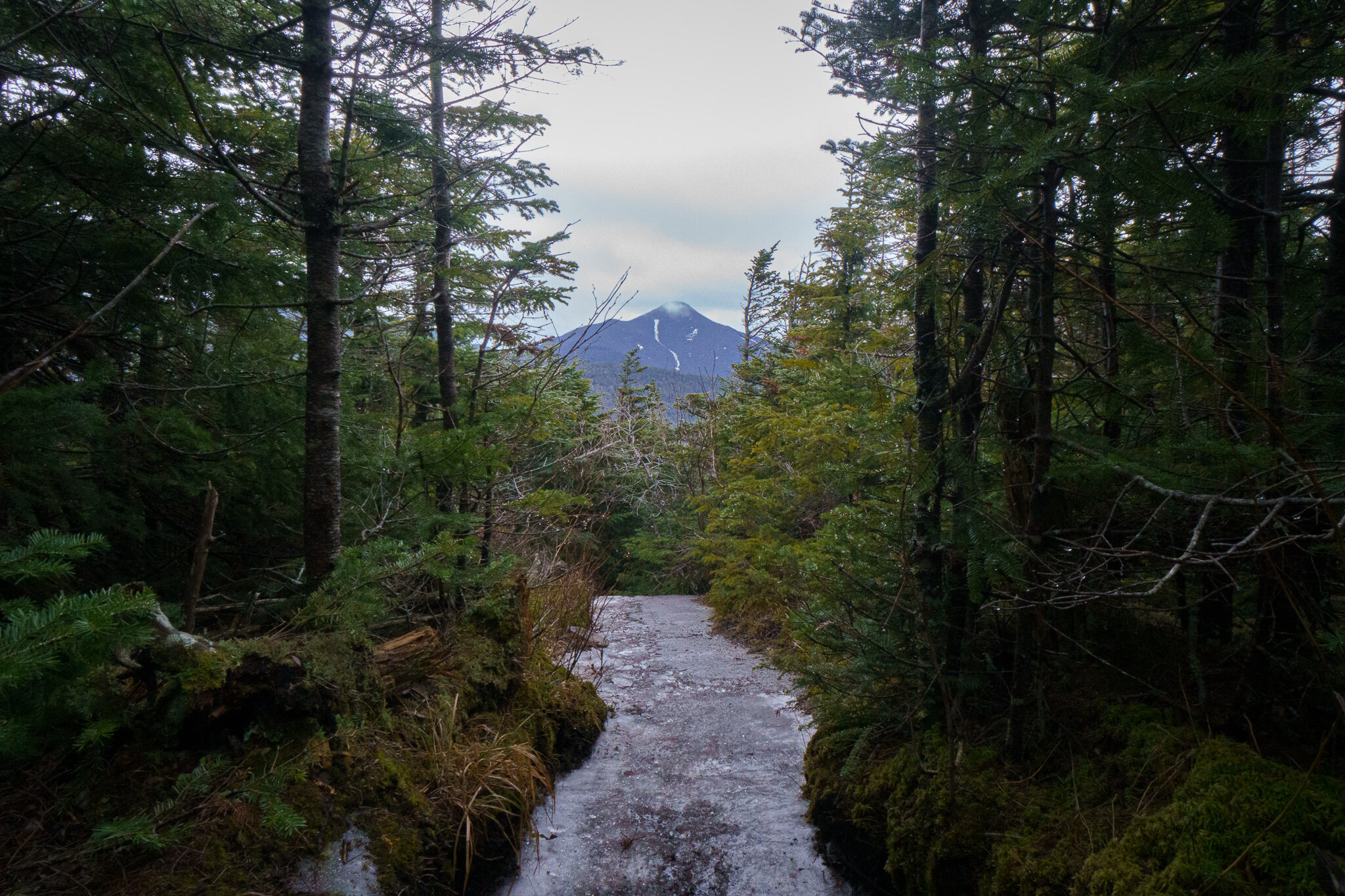
When I got out of the labyrinth, I turned onto the Big Stonecoal Trail. As the path left the rolling plains, it began to descend into a lush wooded valley. The mild redness of my skin welcomed the shade.

It was about this time that I noticed I was running low on daylight. The unrelenting mud and indistinct detours had delayed me more than I realized.
The way the planning worked out for this trip, day one was front loaded with the most mileage, and I still had a few more to go.
At this rate, I would be arriving at my planned campsite well into the 7 o’clock hour. Much later than I was anticipating.
Dolly Sods is a popular place for wilderness backpacking and this late in the day, many of the precious few areas suitable for a campsite, including the one I was hoping for, had been claimed by other adventurers.
Through my research I had heard that these spots along the Stonecoal Trail were some of the best in the area. Apparently I wasn’t the only one who had heard that. I had to hoof it an additional unplanned mile or so to find a workable area as the sun was setting.
What I found was less than optimal. The ground was uneven, and I was a bit closer to a marsh than I would have liked, but for the night, I would call it home.
I set up my tent, and ate dinner by the dim light of my headlamp.
Day 2: Climbing Cliffs and Crossing Streams.
Surprisingly, after the frustrations of the day prior, I slept like a rock.
Maybe it’s the sounds of nature, maybe it’s the exhaustion, but some of the best sleep I have ever had has been inside a tent.
As I crawled out of the mesh door and did my morning stretches, I walked over to check on my shirt hanging from a branch.
Still wet.
I generally bring two sets of clothing on these adventures. One set for hiking, one to wear in camp. As my hiking clothes become soaked from sweat or rain, it’s nice to change into something dry and relatively clean to sleep in.
Hanging up my hiking clothes to dry overnight did me no good this time. Due to the humidity, they were just as wet as when I left them.
But I hadn’t had my coffee yet, so that’s a problem for after-breakfast-me.
And screw that guy.
I found my bearbag in the branches where I had left it in the dark of the evening prior. Using a small boulder as a coffee table, I began my morning routine.
I was about to take my first sip of coffee when a visitor wandered into camp to greet me.
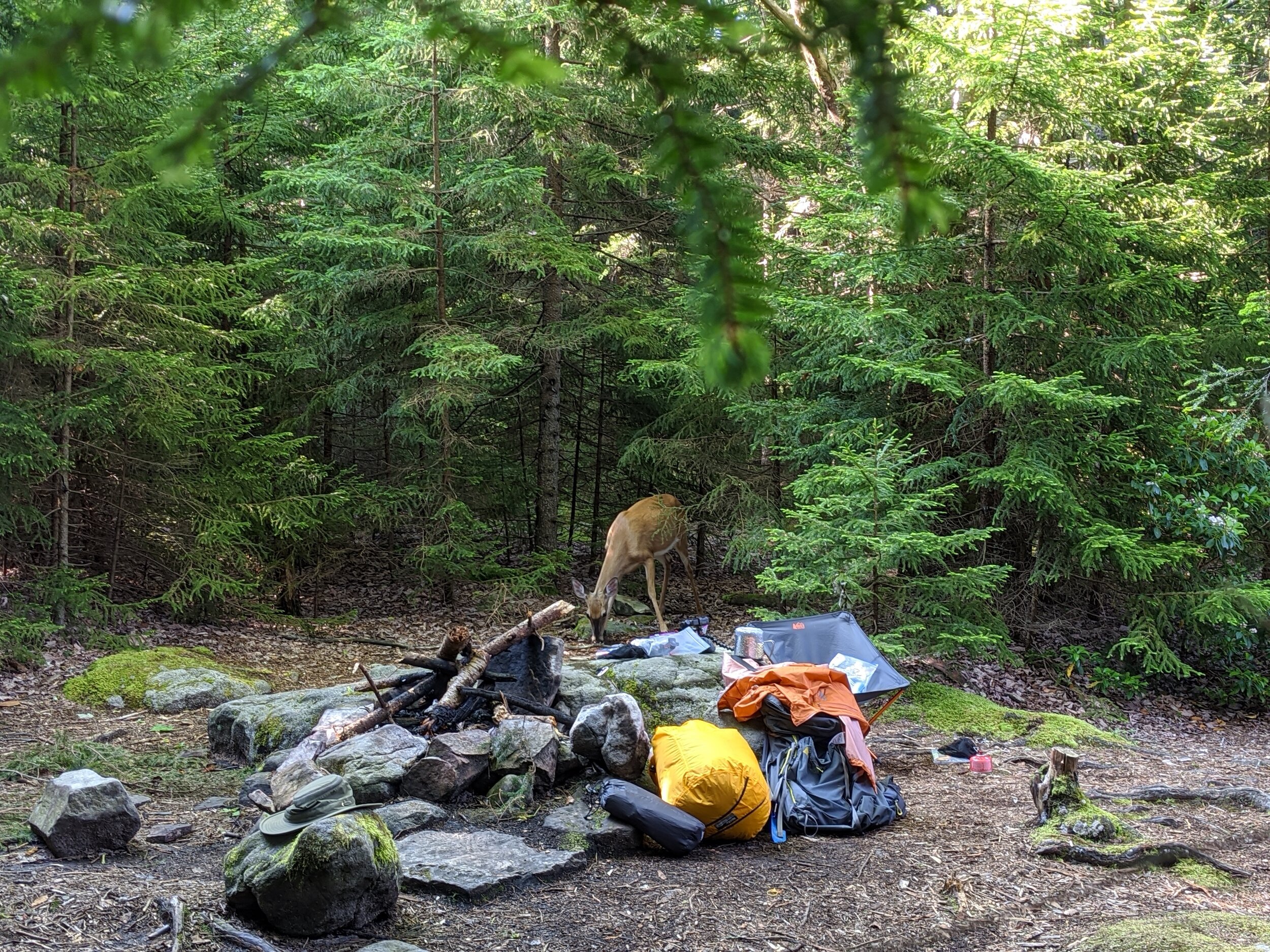
She got surprisingly close. Desensitized to humans camping in this area, she was probably looking for food scraps. I hoped she hadn’t become dependent on it. (Don’t feed the wild life!)
As I finished my breakfast, we prepared to go our separate ways and I began to pack my gear. We continued to exchange glances as I finished up.
She wasn’t much of a conversationalist. But then again, neither was I.
“Speak only if it improves upon the silence” seemed to be both our mottos.

As I set off back down the trail, there was a distinct change of scenery from the day prior. The dense forest was covered with a tall canopy, and filled with dense thickets of rhododendron shrubs.
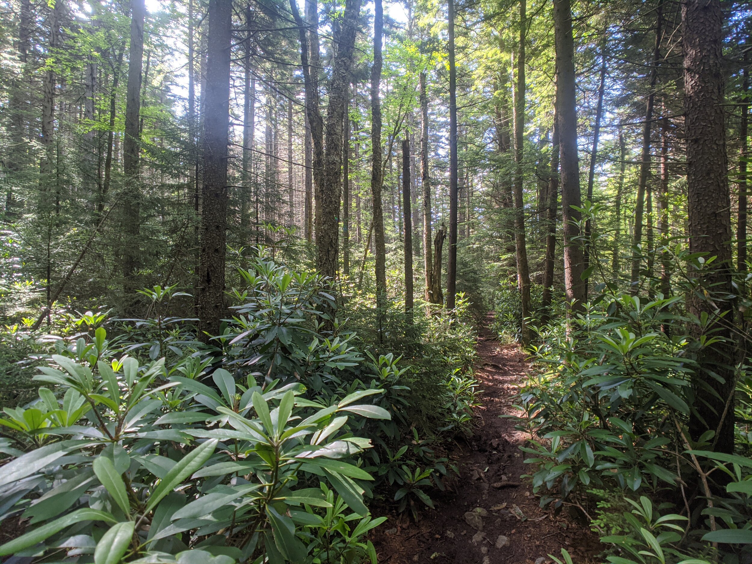
The humidity and mud made the rocks and boulders slippery. My trekking poles saved my butt more than a couple of times.
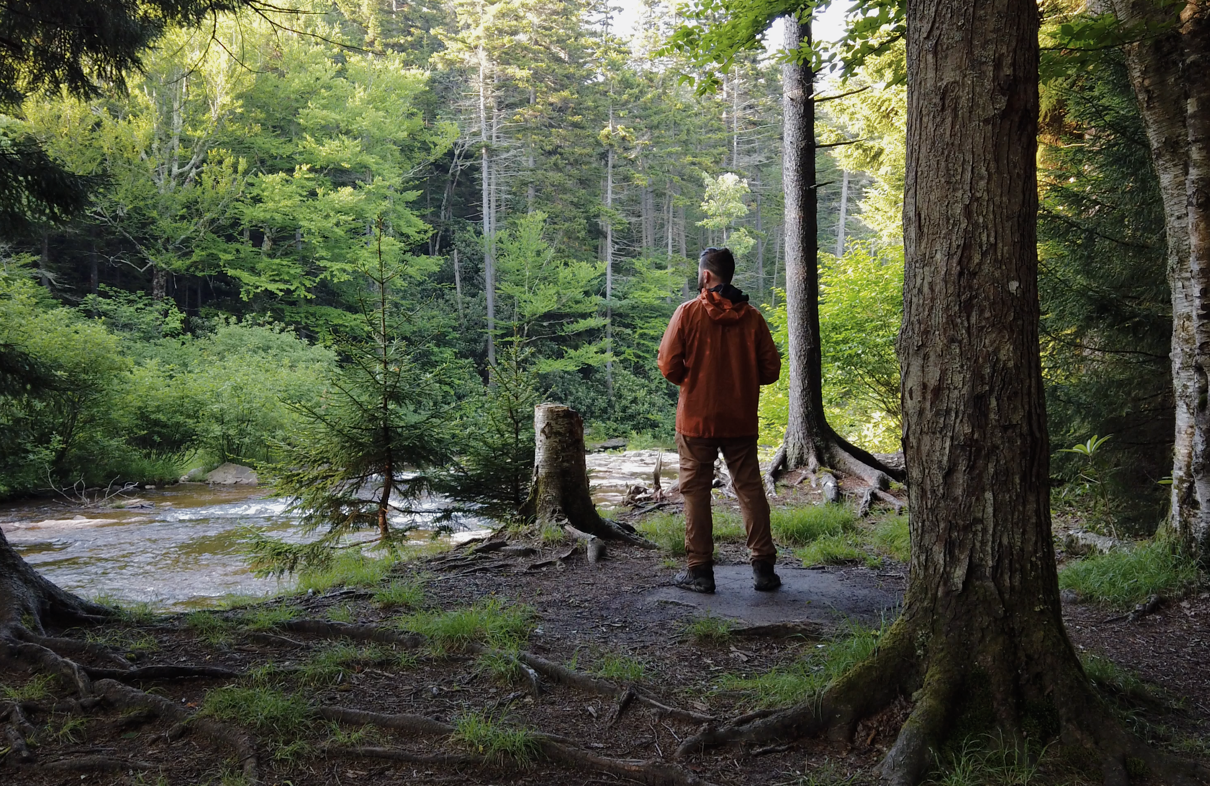
As I wandered on, I stopped to admire the Stonecoal Run Waterfall.

About a half mile later I took a side trip up the Rocky Point Trail to Lion's Head to check out the best view in all of Dolly Sods.
It was about a mile and a half round trip for the detour, but well worth it.
On top of this hill there was a beautiful pine forest next to what would be an amazing camp spot if one brought enough water.
There is something peaceful about pine forests. The needle leaves like to grow only where they can get consistent sunlight. Which tends to mean a forest of them seems like they have a piney roof and walls, with a spacious interior of only pine wood beams.
Homey.
Leaving the piney abode, I bushwhacked through some dense vegetation to finally get a glimpse of Lions Head.
Somehow I overshot my target and wound up just east of it. But it gave me a nice view of where I wanted to go.

If I said I had a trail to follow up here, I would use the word “trail” in the loosest sense. So I carefully continued on, bouncing between beaten paths and bushwacking. Until finally emerging onto the Lion’s Head.

After spending a shameless amount of time taking in the view, I backtracked to Big Stonecoal Trail, and descended deeper into the valley.
Not too long after, I crossed paths with a couple hikers coming my way. They warned me of a stream crossing coming up.
I was gracious, but immediately thought, “Come on man, you think I would come out here without doing my research?”
I knew what I was getting myself into.
But he continued on, explaining how they were almost pulled downstream by the current.
Oh…
I did not know what I was getting myself into.
As I made my way down to the shore line, I could see that days of rain prior had caused the stream to swell.
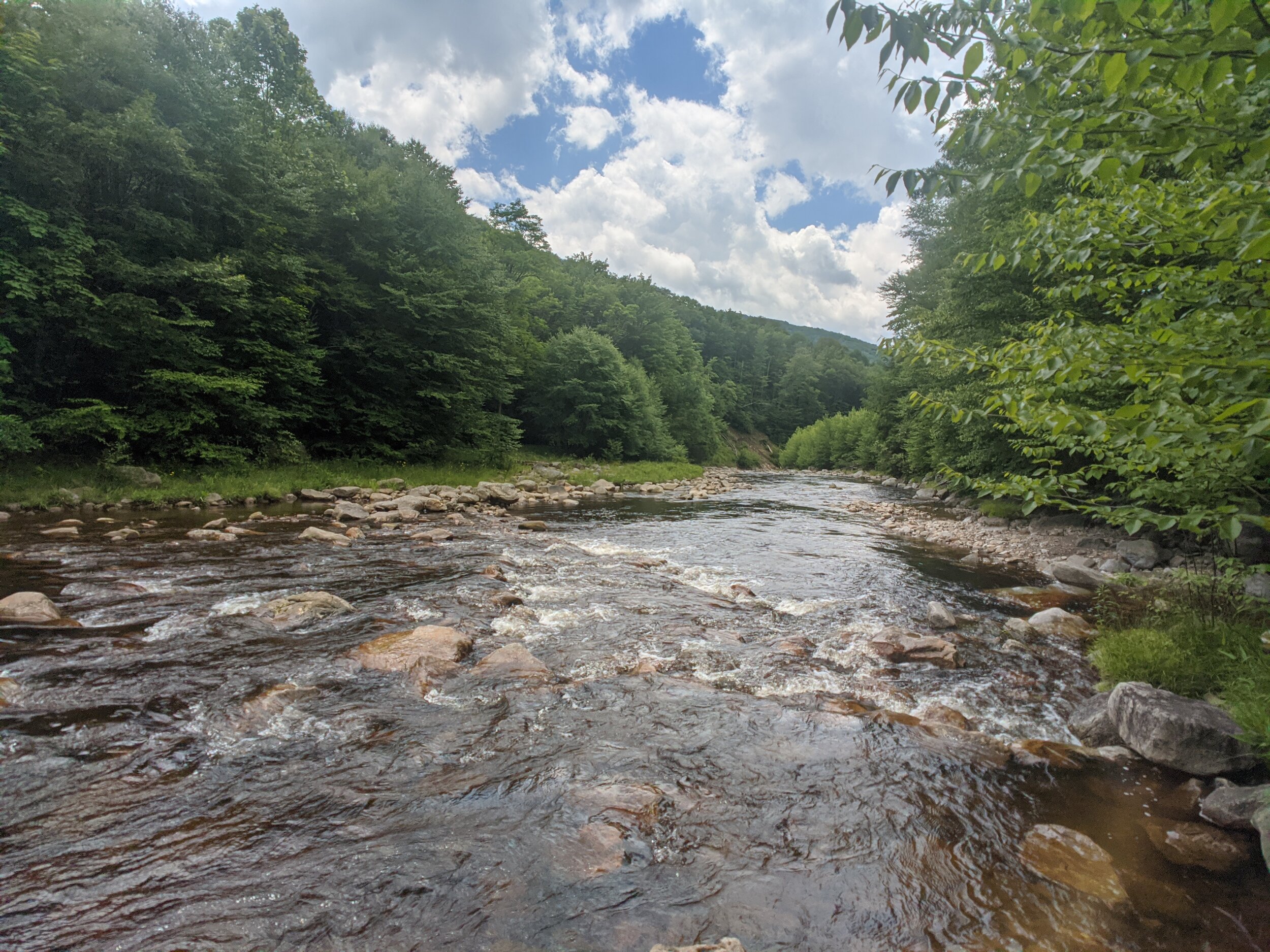
I knew I was going to have to do a stream crossing, but I assumed I was going to have to rock hop here or there to make it across.
I was not expecting this.
After searching for the best way across, I succumbed to the reality that there was no way I was going to continue on without getting in the water.
So I took off my boots, strung them across my neck and forded the river barefoot.
The trekking poles again were clutch in this situation.
The rocks were slippery and the current was strong. I am certain I would have taken a dunk had I not had the extra set of limbs.
When stream crossing, as with scrambling up boulders, you always want to maintain three points of contact.
Once I got to the Southern bank, I decided this would be a great place to rest for lunch as I did my best to dry off.
After my tuna pouch and Clif Bar meal, I continued on the Red Creek Trail.
This deep into the valley between mountains, the air was significantly more humid, if that can be believed. I could visibly see a haze among the trees. It almost looked like a rainforest.

As I pushed on I could feel the symptoms of overheating creeping up. The headache, the dizziness, the flush face.
I had been a heat casualty once before while training for Iraq in the summer sun of the Mojave Desert. It was not a good time. And according to our Corpsmen at the time, once you experience heat exhaustion, you become more susceptible to it in the future.
To combat this, I never hike without electrolyte salt pills in my first aid kit. I take one as soon as I start to feel myself sweating too much.
They’re basically like a gatorade in pill form and help regulate your body temperature.
Heat exhaustion can creep up on you in these situations. It was not particularly hot that day, and I was in shade. But humidity can create more of a risk of overheating than temperature alone, as it makes it difficult for your sweat to evaporate and carry heat away with it.
Truth be told, I felt much cooler in the exposed sun the day prior as the breeze was able to pull that heat away.
Here in this faux rainforest, the air was stagnant and wet. I would have to pace myself if I didn’t want to become a heat casualty again.
So pace myself I did. And after two more miles I had to cross to the stream AGAIN to get back to the North side.
In retrospect I would have ditched the stream crossings and hiked below/around Lions Head instead of descending deeper into the valley.
There wasn’t much to gain from it scenery wise. And the stream crossings definitely made for some annoying slowdowns.

But hey, these unforeseen challenges are the stuff adventures are made of.
As I made my way North, I eventually found myself in a cozy spot nestled between three hills where the Red Creek forks.
Arriving at a decent hour this time, I found a great campsite on the banks of a babbling brook.
It’s amazing how a good campsite can turn the frustrations of the whole day around.
There is nothing I like more than kicking my feet up after a long day of hiking, and enjoying the scenery as the sun goes down.

Day 3: More Muddy Meadow Meandering
The morning was relaxed and peaceful.
I ate my granola and took my time sipping coffee by the stream. If I had brought the supplies, I could have been convinced to stay an extra night in this spot.
But I had trails to roam, and miles to go to get back home.
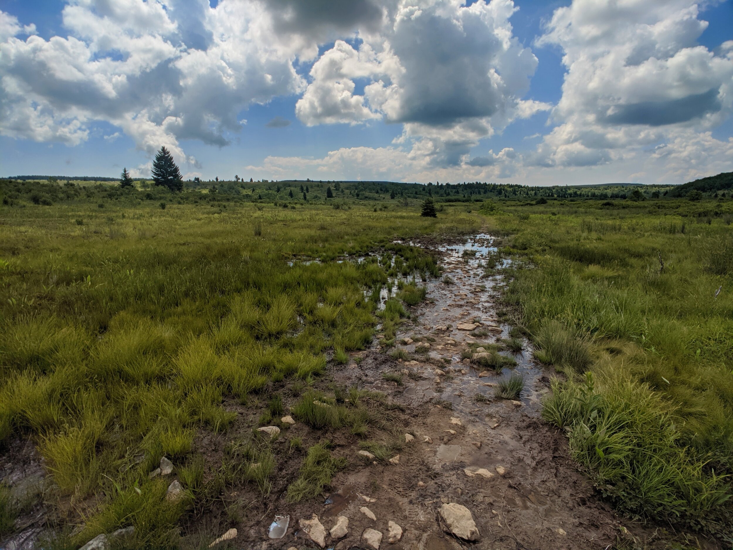
I continued to climb North out of the wooded valleys and back into the muddy meadowlands.
These beautiful wide open spaces were a site to see. I began to wonder how this area formed to be so geologically distinct from its wooded neighbor.
I made a note in my journal to ask an environmental scientist I know about it when I got home.
As beautiful as the view was, what was not so beautiful was a return to the ankle deep mud.
The day was a bit of a maze switching from the Red Creek Trail, to Blackbird Knob, to the Upper Creek Trail, over to Dobbin Grade, but I kept my general Northerly course.
The marshland that was the Dobbin Grade Trail was unmistakable. I mean really, who puts a trail in a marsh!?
Climbing out of the muck and the mire, I found an amazing spot on a hill with a view of the valley below. I decided to break for lunch early so I could have a reason to loiter a bit.

I stayed for as long as it took my butt to go numb from sitting on a downed log. Okay, maybe just a bit longer than that.
When I finally linked back up with the Bear Rocks Trail, I turned East to retrace my steps from two days prior, and hiked back to the trailhead where my Jeep awaited me.
I feel like I got a good taste of the Dolly Sods Wilderness over the last 3 days. But as I drove away, I thought about how I may have to come back, as there were still many more miles to explore.