Phelps Mtn: Adirondacks High Peaks Wilderness

It was Thanksgiving, and not wanting my dining room to become a super spreader event, I decided to instead head out into the mountains.
My only objective on this trip was to recharge with 3 days in naturey solitude. But I figured while I’m out there, I might as well get one of the Adirondack High Peaks under my belt.
At only 8.5 miles for a ‘there and back’ trip from the trailhead, Phelps Mountain could be done as a day hike if you’re up for it. Or, if you’re like me and want to take your time, you can set up a basecamp around Marcy Dam and take your pick of peaks around that area.
Day 1: Dam, Marcy!
My journey began at the familiar Adirondak Loj. As a great launching point to tackle several high peaks, I had been there many times before. Most notably from when I took on the highest peak in New York State, Mount Marcy

I had heard the Loj had gotten crazy busy this summer from droves of people re-discovering the great outdoors during the Covid pandemic. But the crowds seem to have dispersed now that it was late November.
I did notice the price for parking had gone up to$15. Good for them. Can’t blame them. All that additional traffic means more trail erosion and maintenance. A lot of work goes into keeping the wilderness wild.
I did come across a few large family groups towards the start of the trail going for a Thanksgiving hike. They seemed… ill prepared.
And by that I mean they were entering a wilderness area with children without any idea where they were going.
Both groups asked if this was a loop hike or if they should turn around.
I’m not trying to poke fun or gate-keep or anything. And I love that people are getting out to enjoy nature, but holy crap. At least look at a map beforehand. This is a 200,000 acre wilderness area, not a town park.
There’s a reason there has been a dramatic increase in search and rescue calls. Enjoy nature, but be safe people. Come prepared.
The approach trail was flat and largely uneventful.
Intermittent freezing rain all day had prevented me from ‘stopping to smell the pines’ as much as I normally do. I was eager to set up camp.

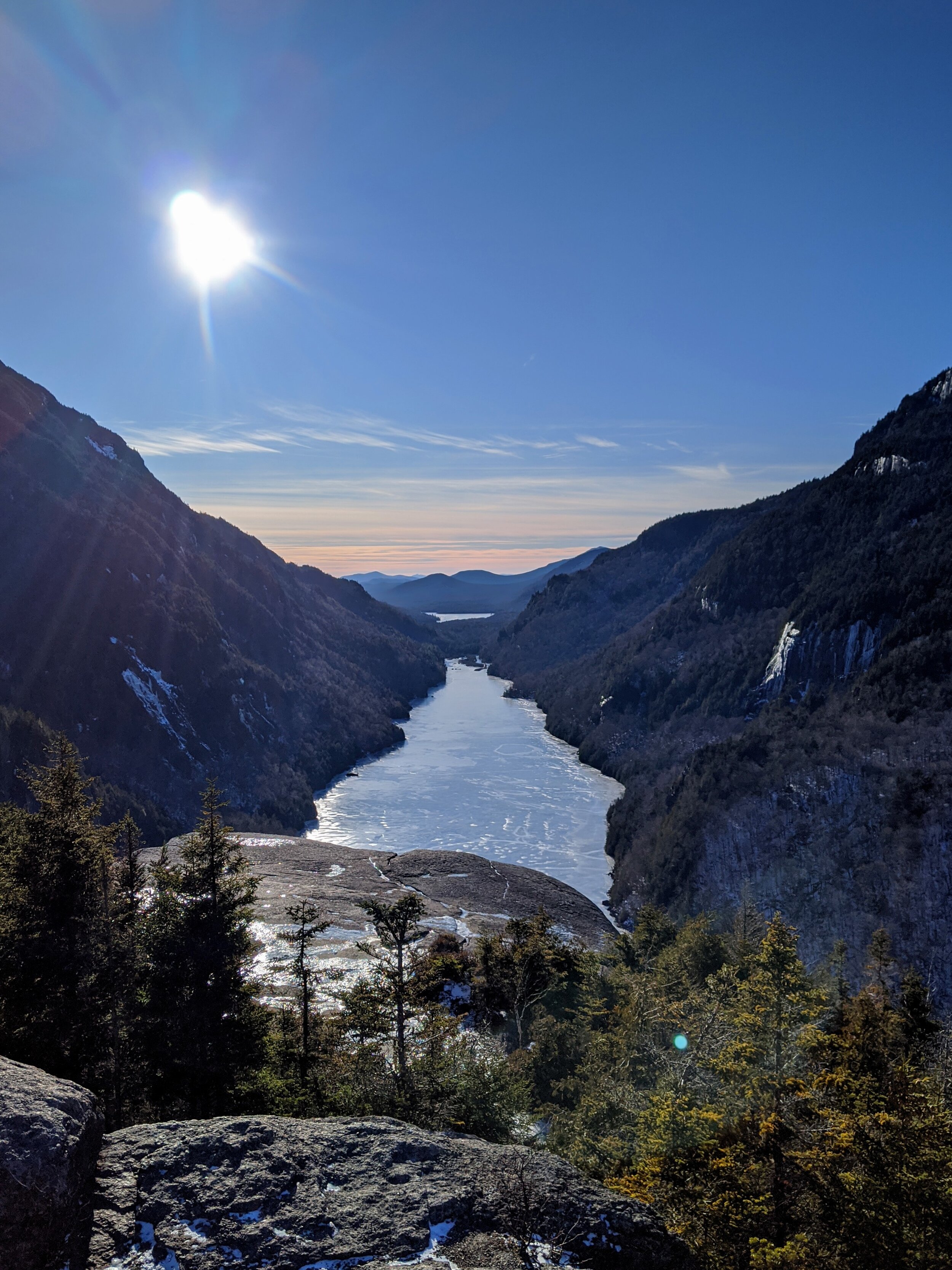
After two miles I got to the the main attraction of the day: The Marcy Dam area
The landscape was stunning. Expansive views of the mountains all around me with rain clouds swooping in low, competing with the peaks for my attention. In front of me flowed Marcy Brook through a meadow that used to be Marcy Lake.


Before this area was a protected wilderness, the logging industry built a series of dams here to help move logs. Hurricane Irene blew the Marcy Dam apart in 2011 and returned the area back to its wild, natural state.
Given enough time, nature always wins.
After drinking up the views, I decided to start looking for a spot to set up camp.
There are plenty of suitable primitive campsites around this area, but I had my heart set on one of the few leanto shelters so that I could spread out a little more than I could in my tent if the freezing rain were to keep up.
After searching for a little bit, I found one on the eastern banks of the brook. Jackpot.

Shelters like this are pretty common on heavily trafficked trails, but I normally avoid sleeping in them as to not be eaten alive by mosquitos. But bugs aren't a problem in late November in the Adirondacks and I was happy to get off the cold muddy ground.
Once I layed out my gear, I went back to the brook to fill up my water supply. God damn was that water cold. My hands went numb almost immediately.
Pro tip: When cold-weather camping, keep your water filter in your pocket and in your sleeping bag with you at night. If it freezes, it will form micro cracks in the filaments and you won’t know about it until you’re pooping your brains out from giardia.
It got dark quick. Such is camping in November. But light from the full moon would occasionally take a sly look through the clouds. And with the leafless trees, it was more than enough to illuminate the area.
5pm being a little too early for me to sleep, I made myself some tea and listened to a few chapters of my audio book until I eventually passed out.
Day 2: Finding my Way Up Phelps Mountain
The night was cold, but tucked within my mummy bag, I was comfortable. Only my eyebrows and nose were exposed. And they noticed.
I had stowed my food in a bearcan away from camp, but made sure I had all the instant-coffee making materials within arms reach to make the transition out of my cocoon more bearable.
It was still dark. I watched as the navy blue sky transitioned to a dim blue glow of cloud cover. I sat, legs still in my sleeping bag, warming my hands by the light of my small stove.

It was quiet. Much quieter than the nature sounds of summer. A person can really be alone out here.
Except for the squirrels. Plenty of squirrels out here.
I think three days, two nights is the perfect length for a quick backpacking trip. Regardless of miles.
First day to travel to the trailhead and hike a while to camp. The third day to wind down the last miles and then travel home. With that perfect day in between, this day, where from pillow to pillow, you are out in nature 100% of the time.
What I like about it is the simplicity of it. All the stressors of home life fall by the wayside as I realized I had only one thing to do that day. Get to the top of Phelps.
So off I went.
Since I was coming back to this camp, I left some of the heavier unneeded gear in the shelter. No point in lugging it up the whole mountain.
I left a note, in case other hikers came through. “Gone to Phelps. Be back later” with the date and time.
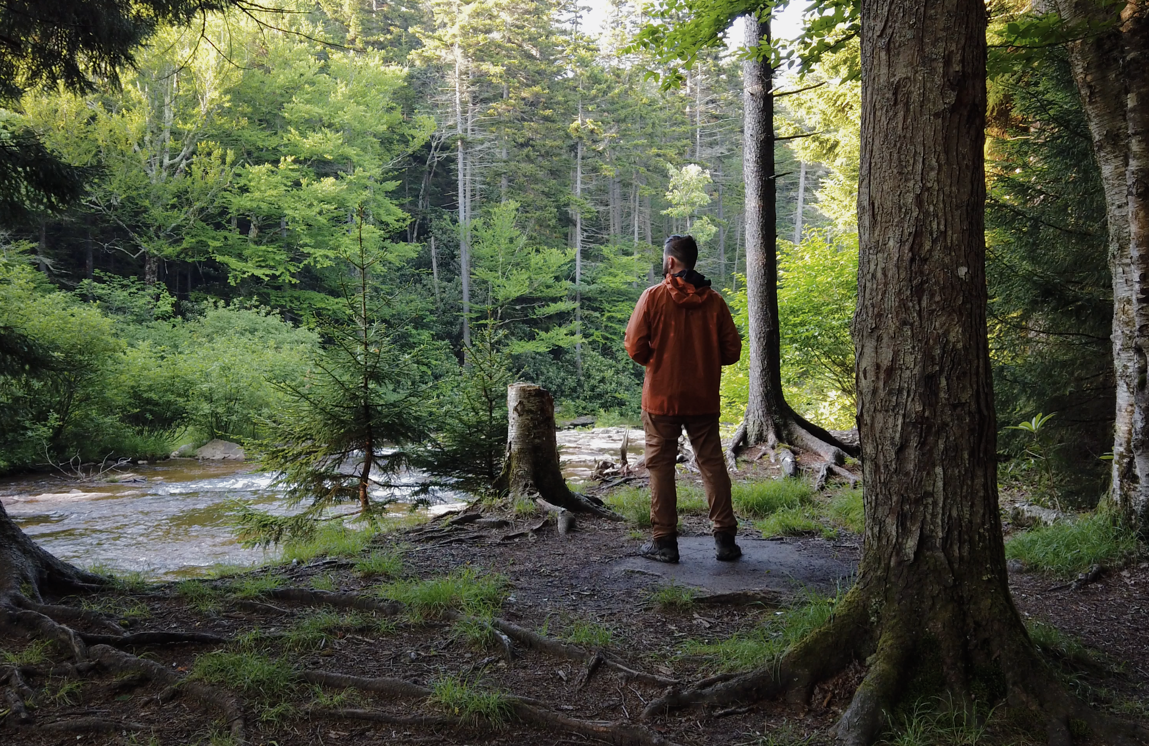
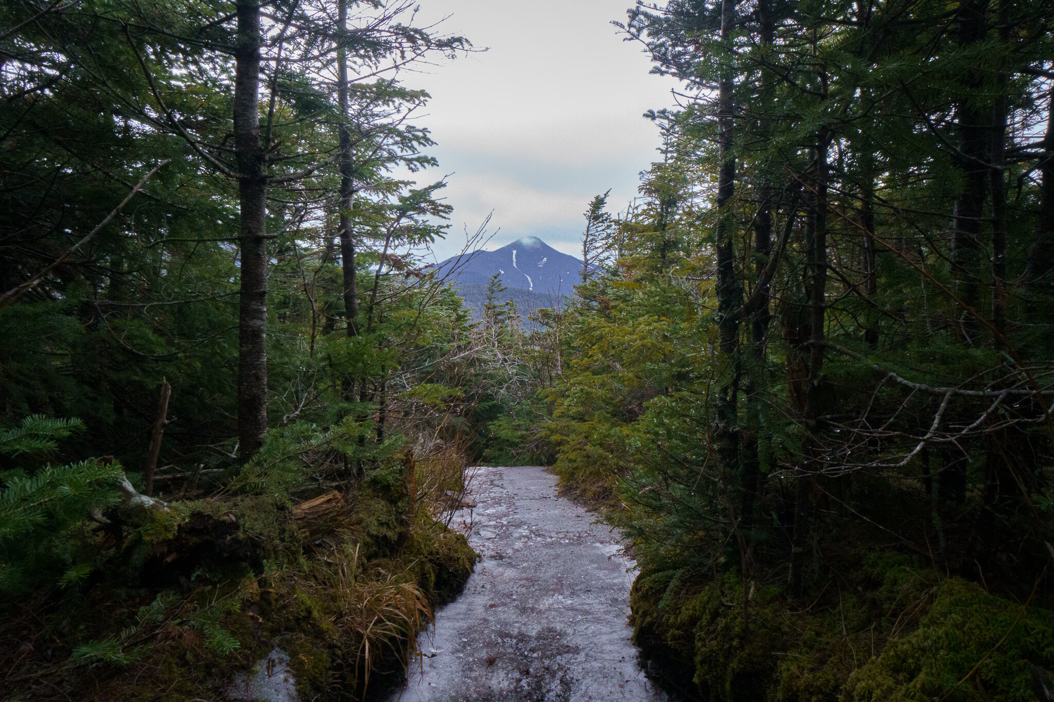
Leaving camp, the trail followed Phelps Brook, which had not yet frozen over at this elevation.

A water crossing was necessary, so waterproof boots were needed. Although not deep, the stream had a current strong enough to push the flowing water over the tops of my feet and up my ankles.
After a mile from the leanto (3.2 miles from Adirondak Loj if doing this in a day), the trail splits, continuing on the Van Hoevenberg Trail towards Mount Marcy, or east to northeast to the Phelps Mountain Trail.


There’s only one mile to the top from here, but almost all the elevation gain happens in this one mile, so it felt like much longer.
I do love a good steep climb in the Adirondacks. The contrast between the varying climate zones is less gradual and more … contrasty.
As I climbed, I noticed the sudden disappearance of deciduous trees, as the conifers dominated the steep slopes.
At around 3,500 ft I felt a dramatic temperature drop. And apparently so did the rocky babbling brook I was climbing up, as it took on a layer of ice with water still flowing underneath.
I decided now was a good time to don my ice cleats to keep traction.

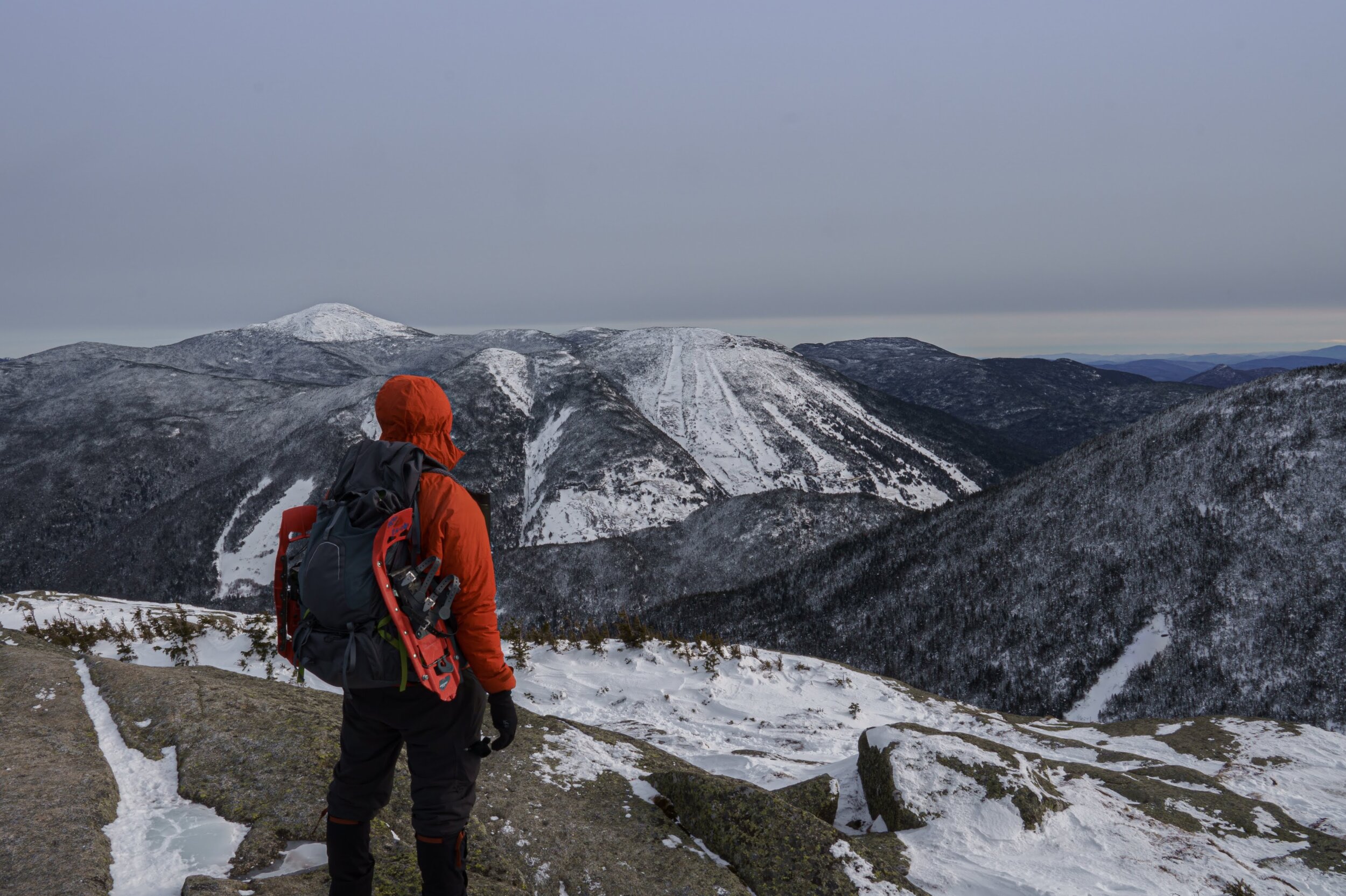
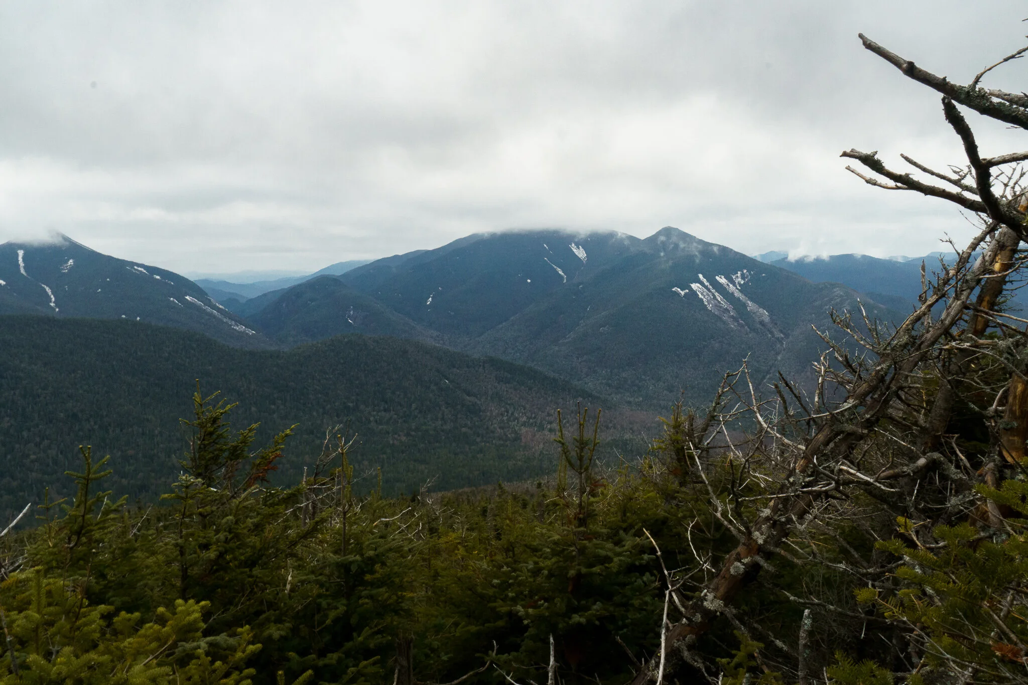
After two hours of climbing, the trees started to get short enough for me to peek through and sneak some views of Algonquin peak and the surrounding mountains.
Don’t use my timeline as a guide though. I stop to take a lot of photos. And I am talking A LOT. Pretty much anything that catches my eye.
I left this particular trip with over 400 shots. Out of them, I was able to cull it down to 29 keepers.
I am very much an amaterature hobbyist when it comes to photography, so I have no idea if that’s a normal ratio or not. Feel free to chime in if you do the same.

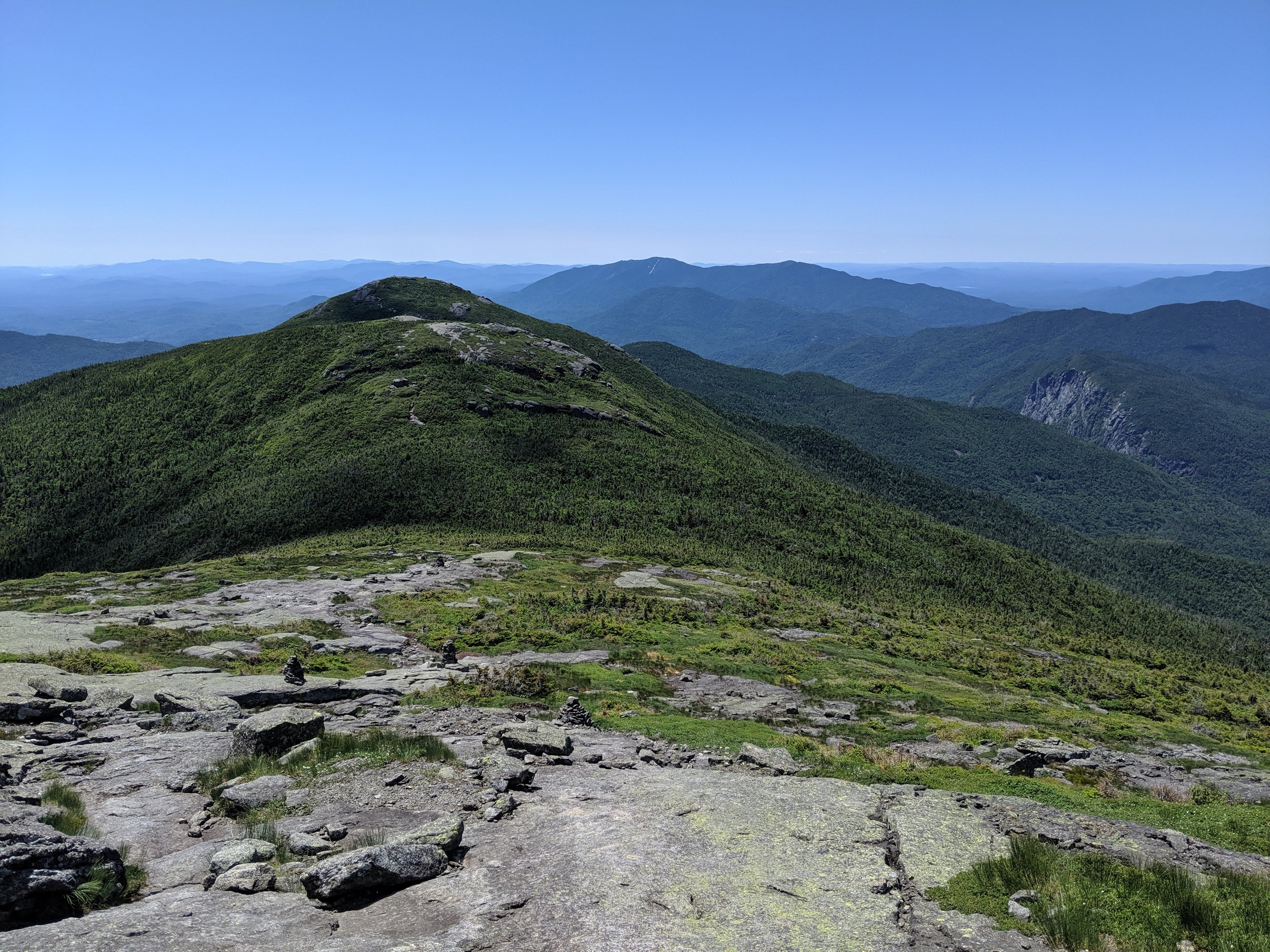
Not long after that, I was at the top. The summit of Phelps opened up to an expansive view of the entire MacIntyre Range (Wright, Algonquin, Iroquois, and Marshall peaks) as well as Mount Colden, Marcy and Haystack.


Hanging out at the summit, I ate a little lunch in the form of a cliff bar, and had my traditional victory summit cigar.
Being November 27th, I also shot off a “Happy Birthday from the summit of Phelps Mtn!” GPS message to my sister in Tennessee.
Eventually the sweat evaporated from my back and the shivers set in. When my hands began to go numb, I decided it was time to head back down.
It was now late afternoon and I knew I only had an hour and some change of daylight left.
But being an ‘out and back’ hike, getting back down was pretty self explanatory.
Gravity was on my side this time, and I made it back to the lean to with some daylight to spare.
Once there, as quickly as I could, I changed into a dry set of non-sweaty clothes and made myself some tea to warm up.
Earl Grey, hot.
I spent the rest of the evening wandering around the Marcy Brook area, listening to my audio book and practicing my low-light photography with the aid of my LED solar lantern.

Day 3: Snowing Morning Departure
I woke up to light snow floating to the ground outside the shelter. It was scenic to watch, though the ground was not cold enough for it to accumulate this low in the valley.
Looking up at Wright Peak however, it was cool to see the sharp elevation line on the mountain side where it was cold enough to accumulate.


Knowing I only had a two mile hike out, I took my time with coffee and breakfast that last morning, reluctant to return back to the grind. Screw that three day rule. I could’ve used a forth. Maybe even get another high peak in
Next time.
After crossing Marcy Brook once more, I trekked the two miles back, finding my Jeep where I left it, and began the long drive home. Already daydreaming of the next adventure.